File:Scythia et Tartaria Asiatica.png
Jump to navigation
Jump to search

Size of this preview: 733 × 600 pixels. Other resolutions: 293 × 240 pixels | 587 × 480 pixels | 939 × 768 pixels | 1,252 × 1,024 pixels | 2,504 × 2,048 pixels | 2,974 × 2,433 pixels.
Original file (2,974 × 2,433 pixels, file size: 13.18 MB, MIME type: image/png)
Captions
Captions
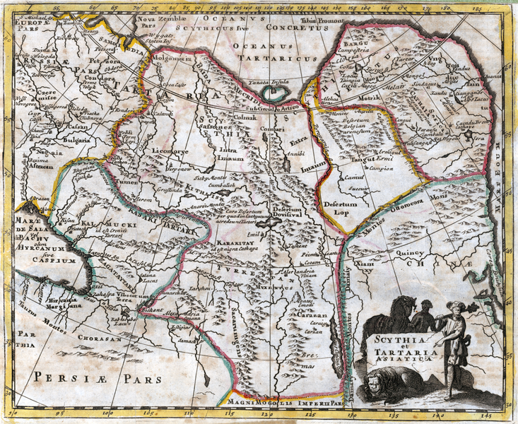
1729 map of North Asia
Summary
[edit]
| Description |
English: Map of Scythia and Tartary, or Central Asia, western U.S.S.R., Mongolia and northern China, showing the coloured boundaries, and Great Wall of China.
From: Philippi Cluveri introductionis in universam geographiam, tam veterem quam novam libri VI. Cum integris Johannis Bunonis, Joh. Frid. Hekelii & Joh. Reiskii, & selectis Londinensibus notis ... |
| Date | |
| Source | https://catalogue.nla.gov.au/Record/1642766 |
| Author | Philipp Cluver |
Licensing
[edit]
This file is licensed under the Creative Commons Attribution-Share Alike 4.0 International license.
- You are free:
- to share – to copy, distribute and transmit the work
- to remix – to adapt the work
- Under the following conditions:
- attribution – You must give appropriate credit, provide a link to the license, and indicate if changes were made. You may do so in any reasonable manner, but not in any way that suggests the licensor endorses you or your use.
- share alike – If you remix, transform, or build upon the material, you must distribute your contributions under the same or compatible license as the original.
File history
Click on a date/time to view the file as it appeared at that time.
| Date/Time | Thumbnail | Dimensions | User | Comment | |
|---|---|---|---|---|---|
| current | 05:41, 23 September 2022 | | 2,974 × 2,433 (13.18 MB) | Austiger (talk | contribs) | Uploaded a work by Philipp Cluver from https://catalogue.nla.gov.au/Record/1642766 with UploadWizard |
You cannot overwrite this file.
File usage on Commons
There are no pages that use this file.