File:Scunthorpe Speedway - geograph.org.uk - 476688.jpg
Jump to navigation
Jump to search
No higher resolution available.
Scunthorpe_Speedway_-_geograph.org.uk_-_476688.jpg (640 × 454 pixels, file size: 67 KB, MIME type: image/jpeg)
Captions
Captions
Add a one-line explanation of what this file represents
Summary
[edit]
| Description |
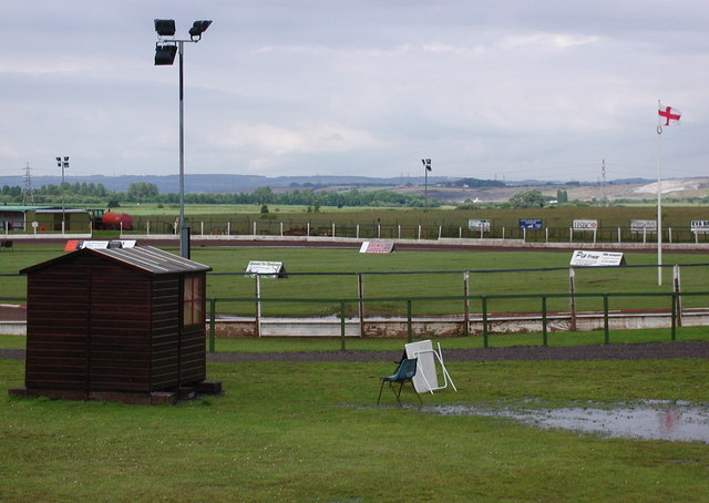
English: Scunthorpe Speedway Former model airplane club off the east side of Normanby Road, Scunthorpe, converted into a speedway circuit in 2005 as a new home for the Scunthorpe Scorpions. Scunthorpe's earlier speedway club, the Scunthorpe Saints, raced at Quibell Park athletics stadium from 1971 until 1978 when speedway was evicted after much heated debate about the condition of the track. A new purpose built circuit (apparently with almost non-existent facilities) was provided at Ashby Ville until the Saints disbanded in 1985. |
| Date | |
| Source | From geograph.org.uk |
| Author | Paul Glazzard |
| Attribution (required by the license) | Paul Glazzard / Scunthorpe Speedway / |
| Camera location | | View this and other nearby images on: OpenStreetMap |
|---|
_heading:22.00&language=en)
| Object location | | View this and other nearby images on: OpenStreetMap |
|---|
_heading:22.00&language=en)
Licensing
[edit]

|
This image was taken from the Geograph project collection. See this photograph's page on the Geograph website for the photographer's contact details. The copyright on this image is owned by Paul Glazzard and is licensed for reuse under the Creative Commons Attribution-ShareAlike 2.0 license.
|
This file is licensed under the Creative Commons Attribution-Share Alike 2.0 Generic license.
Attribution: Paul Glazzard
- You are free:
- to share – to copy, distribute and transmit the work
- to remix – to adapt the work
- Under the following conditions:
- attribution – You must give appropriate credit, provide a link to the license, and indicate if changes were made. You may do so in any reasonable manner, but not in any way that suggests the licensor endorses you or your use.
- share alike – If you remix, transform, or build upon the material, you must distribute your contributions under the same or compatible license as the original.
File history
Click on a date/time to view the file as it appeared at that time.
| Date/Time | Thumbnail | Dimensions | User | Comment | |
|---|---|---|---|---|---|
| current | 23:17, 4 February 2011 | | 640 × 454 (67 KB) | GeographBot (talk | contribs) | == {{int:filedesc}} == {{Information |description={{en|1=Scunthorpe Speedway Former model airplane club off the east side of Normanby Road, Scunthorpe, converted into a speedway circuit in 2005 as a new home for the Scunthorpe Scorpions. Scunthorpe's earl |
You cannot overwrite this file.
File usage on Commons
There are no pages that use this file.
File usage on other wikis
The following other wikis use this file:
- Usage on en.wikipedia.org
- Usage on www.wikidata.org