File:Schwarzes Meer BV043420907.jpg
Jump to navigation
Jump to search
Size of this preview: 386 × 600 pixels. Other resolutions: 154 × 240 pixels | 309 × 480 pixels | 494 × 768 pixels | 659 × 1,024 pixels | 2,010 × 3,124 pixels.
Original file (2,010 × 3,124 pixels, file size: 565 KB, MIME type: image/jpeg)
Captions
Captions
Add a one-line explanation of what this file represents
Summary
[edit]| Title |
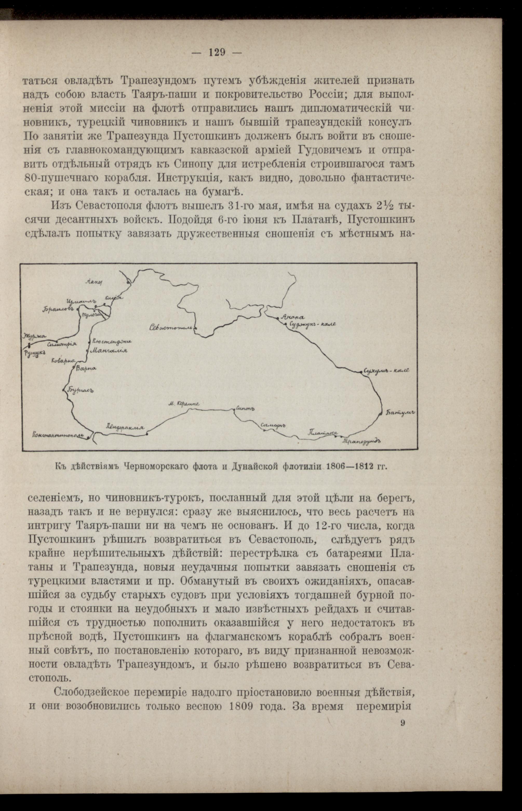
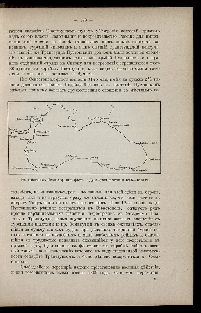
K dějstvījam Černomorskago flota i Dunajskoj flotilīi 1806 - 1812 gg. |
|||||||||||||||||||||||
| Description |
Deutsch: SchwarzesMeerSeeschlacht |
|||||||||||||||||||||||
| Date | ||||||||||||||||||||||||
| Source | Leibniz-Institut für Ost- und Südosteuropaforschung (IOS) GeoPortOst | |||||||||||||||||||||||
| Permission (Reusing this file) |
|
|||||||||||||||||||||||
| Geotemporal data | ||||||||||||||||||||||||
| Date depicted | from 1806 until 1812 | |||||||||||||||||||||||
| Map location | Schwarzes Meer | |||||||||||||||||||||||
| Map type | Geschichtskarte | |||||||||||||||||||||||
| Bounding box |
|
|||||||||||||||||||||||
| Georeferencing | ||||||||||||||||||||||||
| Bibliographic data | ||||||||||||||||||||||||
| Map sheet | S. 129 | |||||||||||||||||||||||
| Language | Russian | |||||||||||||||||||||||
| Archival data | ||||||||||||||||||||||||
| Collection |
|
|||||||||||||||||||||||
| Accession number |
BV043420907 |
|||||||||||||||||||||||
| Other versions | ||||||||||||||||||||||||


Licensing
[edit]
|
This work is in the public domain in its country of origin and other countries and areas where the copyright term is the author's life plus 70 years or fewer. | |
| This file has been identified as being free of known restrictions under copyright law, including all related and neighboring rights. | |
File history
Click on a date/time to view the file as it appeared at that time.
| Date/Time | Thumbnail | Dimensions | User | Comment | |
|---|---|---|---|---|---|
| current | 20:02, 19 February 2019 | | 2,010 × 3,124 (565 KB) | H.bauer26 (talk | contribs) | pattypan 18.02 |
You cannot overwrite this file.
File usage on Commons
The following page uses this file: