File:Schmalkaldic war 1547.jpg
Jump to navigation
Jump to search

Size of this preview: 373 × 599 pixels. Other resolutions: 149 × 240 pixels | 299 × 480 pixels | 478 × 768 pixels | 1,047 × 1,680 pixels.
Original file (1,047 × 1,680 pixels, file size: 535 KB, MIME type: image/jpeg)
Captions
Captions
Add a one-line explanation of what this file represents
Summary
[edit]
| Description |
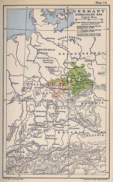
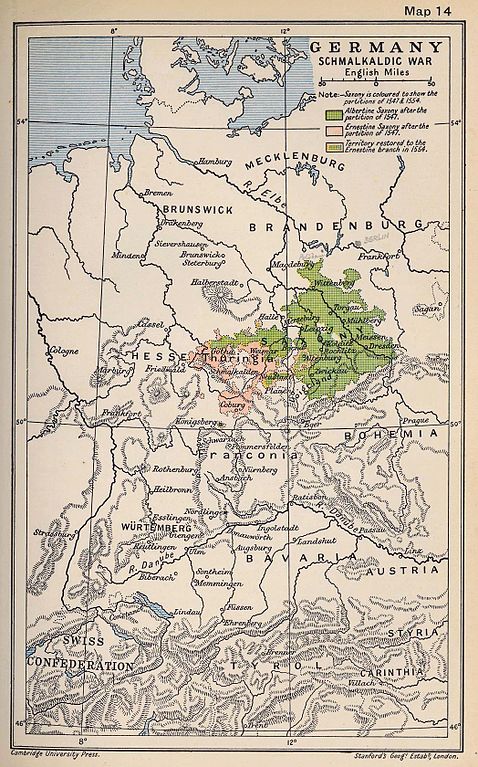
Hrvatski: Karta Schmalkaldskog rata English: Map of Schmalkaldic war |
| Date | |
| Source | Taken from the 1912 Cambridge Modern History Atlas, Map 14. Because it was printed in both London and New York in 1912, it is now in the public domain. |
| Author | Cambridge |
Licensing
[edit]
This media file is in the public domain in the United States. This applies to U.S. works where the copyright has expired, often because its first publication occurred prior to January 1, 1929, and if not then due to lack of notice or renewal. See this page for further explanation.
|
 | |
 |
Original upload log
[edit]
The original description page was here. All following user names refer to en.wikipedia.
- 2007-03-29 22:09 HansHermans 1047×1680× (507301 bytes) Taken from the 1912 ''Cambridge Modern History Atlas'', Map 14. Because it was printed in both London and New York in 1912, it is now in the public domain.
File history
Click on a date/time to view the file as it appeared at that time.
| Date/Time | Thumbnail | Dimensions | User | Comment | |
|---|---|---|---|---|---|
| current | 17:22, 24 April 2017 | | 1,047 × 1,680 (535 KB) | Soerfm (talk | contribs) | Color, brightness |
| 07:48, 9 December 2011 |  | 1,047 × 1,680 (495 KB) | Quahadi (talk | contribs) | {{Information |Description={{hr|Karta Schmalkaldskog rata}}{{en|Map of Schmalkaldic war}} |Source=http://en.wikipedia.org/wiki/File:Schmalkaldic_war_1947.jpg (1912 Cambridge Modern History Atlas) |Date=1912 |Author=Cambridge |Permission= |other_versions= |
You cannot overwrite this file.
File usage on Commons
The following page uses this file:
File usage on other wikis
The following other wikis use this file:
- Usage on en.wikipedia.org
- Usage on es.wikipedia.org
- Usage on et.wikipedia.org
- Usage on hr.wikipedia.org
- Usage on id.wikipedia.org
- Usage on it.wikipedia.org
- Usage on ja.wikipedia.org
- Usage on sh.wikipedia.org
- Usage on sr.wikipedia.org