File:Schloss Stubenberg 3.jpg
Jump to navigation
Jump to search

Size of this preview: 331 × 599 pixels. Other resolutions: 132 × 240 pixels | 265 × 480 pixels | 424 × 768 pixels | 565 × 1,024 pixels | 1,576 × 2,854 pixels.
Original file (1,576 × 2,854 pixels, file size: 2.99 MB, MIME type: image/jpeg)
Captions
Captions
Add a one-line explanation of what this file represents
Summary
[edit]
| Description |
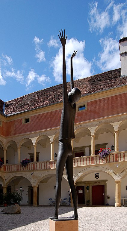
English: Schloss Stubenberg (Castle Stubenberg) in Stubenberg, Styria, is a former monastery and now a hotel.
It is a cultural heritage monument now. Deutsch: Das Schloss Stubenberg in Stubenberg in der Steiermark ist ein ehemaliges Kloster (Kloster St. Josef der Franziskanerinnen) und jetziges Hotel. Es steht unter Denkmalschutz. |
| Date | |
| Source | Own work |
| Author | Herzi Pinki |
| Camera location | | View this and other nearby images on: OpenStreetMap |
|---|
Licensing
[edit]
I, the copyright holder of this work, hereby publish it under the following license:
This file is licensed under the Creative Commons Attribution-Share Alike 3.0 Unported license.
- You are free:
- to share – to copy, distribute and transmit the work
- to remix – to adapt the work
- Under the following conditions:
- attribution – You must give appropriate credit, provide a link to the license, and indicate if changes were made. You may do so in any reasonable manner, but not in any way that suggests the licensor endorses you or your use.
- share alike – If you remix, transform, or build upon the material, you must distribute your contributions under the same or compatible license as the original.
|
Freedom of Panorama This picture of an otherwise copyrighted work may be distributed under the conditions of § 54 (1) Z. 5 of the Austrian copyright law which allows to reproduce, distribute, and publish architectural works of an actual building or other works of visual arts which were created to permanently remain at a public place. Note: Due to the principle of Lex loci protectionis, this applies only to reuse of this picture in Austria. Reuse in other countries is subject to local law. Further information can be found on Commons and in German Wikipedia.
|
File history
Click on a date/time to view the file as it appeared at that time.
| Date/Time | Thumbnail | Dimensions | User | Comment | |
|---|---|---|---|---|---|
| current | 19:36, 27 June 2011 | | 1,576 × 2,854 (2.99 MB) | Herzi Pinki (talk | contribs) |
You cannot overwrite this file.
File usage on Commons
There are no pages that use this file.