File:Schenectady Map 1750.jpeg
Jump to navigation
Jump to search

Size of this preview: 787 × 599 pixels. Other resolutions: 315 × 240 pixels | 630 × 480 pixels | 1,009 × 768 pixels | 1,204 × 917 pixels.
Original file (1,204 × 917 pixels, file size: 930 KB, MIME type: image/jpeg)
Captions
Captions
Add a one-line explanation of what this file represents
Summary
[edit]
| Description |
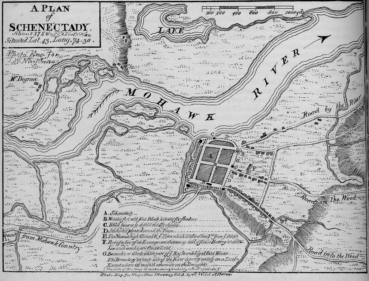
English: Map of Schenectady, New York during the break between King George's War and the French and Indian War |
| Date | |
| Source | Schenectady Digital History Archive |
| Author | A. Wild |
| Camera location | | View this and other nearby images on: OpenStreetMap |
|---|
Licensing
[edit]
| I, the copyright holder of this work, release this work into the public domain. This applies worldwide. In some countries this may not be legally possible; if so: I grant anyone the right to use this work for any purpose, without any conditions, unless such conditions are required by law. |
File history
Click on a date/time to view the file as it appeared at that time.
| Date/Time | Thumbnail | Dimensions | User | Comment | |
|---|---|---|---|---|---|
| current | 16:32, 6 September 2010 | | 1,204 × 917 (930 KB) | MattWade (talk | contribs) | {{Information |Description={{en|1=Map of Schenectady, en:New York during the break between en:King George's War and the en:French and Indian War}} |Source=[http://www.schenectadyhistory.org/maps/citymap1750_ |
You cannot overwrite this file.
File usage on Commons
There are no pages that use this file.
File usage on other wikis
The following other wikis use this file:
- Usage on en.wikipedia.org