File:Satellite image of 2015 Southeast Asian haze - 20150905.jpg
Jump to navigation
Jump to search

Size of this preview: 671 × 599 pixels. Other resolutions: 269 × 240 pixels | 538 × 480 pixels | 860 × 768 pixels | 1,147 × 1,024 pixels | 2,293 × 2,048 pixels | 4,881 × 4,359 pixels.
Original file (4,881 × 4,359 pixels, file size: 11.93 MB, MIME type: image/jpeg)
Captions
Captions
Add a one-line explanation of what this file represents
Summary
[edit]
| Description |
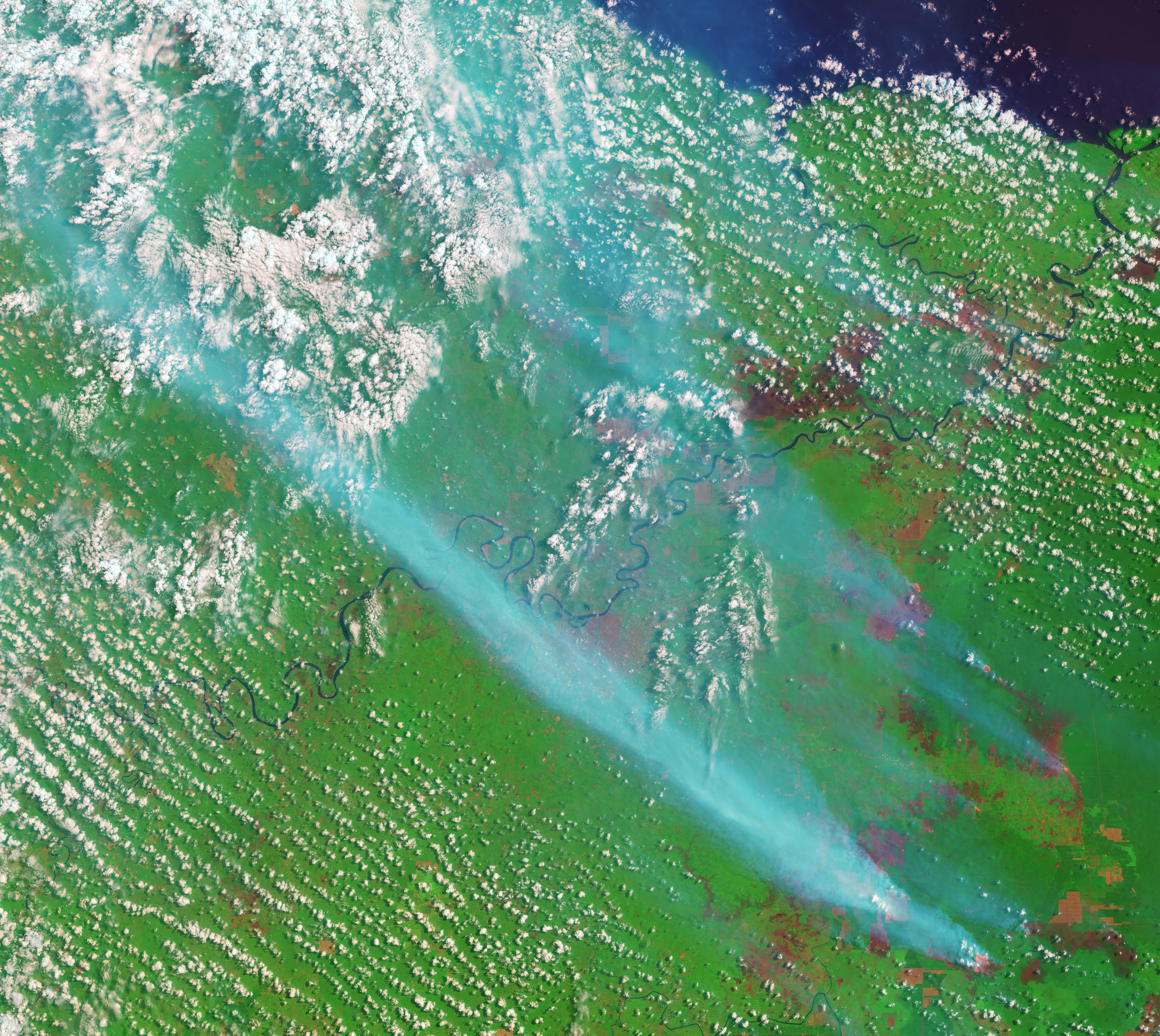
English: On September 5, 2015, the Operational Land Imager on the Landsat 8 satellite acquired this image of smoke billowing from fires in Jambi Province on the Indonesian island of Sumatra. The false-color image was made with a combination of visible (green) and infrared light so that fires and freshly burned land stand out. Fires glow orange, and newly burned land is dark red. The blue smudges running diagonally across the image are smoke. Bare soil or older burn scars are a lighter shade of red. Clouds are white. The lower image shows a broader view of the area.
Caption by Adam Voiland.The fact that the fires burned within well-defined rectangular grids suggests that these were agricultural fires intentionally set by growers. According to land-use maps published by Global Forest Watch, the fires are burning within a palm oil plantation. Palm oil production is highly profitable, and the commodity is an important export for Indonesia, the world’s largest producer. The Jakarta Post reported that heavy smoke from the fires in Sumatra has caused levels of air pollution to spike throughout the island and in parts of Malaysia. |
| Date | |
| Source | http://eoimages.gsfc.nasa.gov/images/imagerecords/86000/86596/jambi_oli_2015248_swir_lrg.jpg |
| Author | NASA Earth Observatory image by Joshua Stevens |
Licensing
[edit]
| This file is in the public domain in the United States because it was solely created by NASA. NASA copyright policy states that "NASA material is not protected by copyright unless noted". (See Template:PD-USGov, NASA copyright policy page or JPL Image Use Policy.) | ||
 |
Warnings:
|
File history
Click on a date/time to view the file as it appeared at that time.
| Date/Time | Thumbnail | Dimensions | User | Comment | |
|---|---|---|---|---|---|
| current | 12:08, 24 September 2015 | | 4,881 × 4,359 (11.93 MB) | RectorRocks (talk | contribs) | {{subst:Upload marker added by en.wp UW}} {{Information |Description = {{en|On September 5, 2015, the {{w|Operational Land Imager}} on the {{w|Landsat 8}} satellite acquired this image of smoke billowing from fires in Jambi Province on the Indonesian i... |
You cannot overwrite this file.
File usage on Commons
There are no pages that use this file.
File usage on other wikis
The following other wikis use this file:
- Usage on zh.wikipedia.org