File:Satellite Image of Tahihe.png
Jump to navigation
Jump to search

Size of this preview: 800 × 452 pixels. Other resolutions: 320 × 181 pixels | 640 × 362 pixels | 1,024 × 579 pixels | 1,280 × 723 pixels | 2,552 × 1,442 pixels.
Original file (2,552 × 1,442 pixels, file size: 6 MB, MIME type: image/png)
Captions
Captions
Add a one-line explanation of what this file represents
Summary
[edit]
| Description |
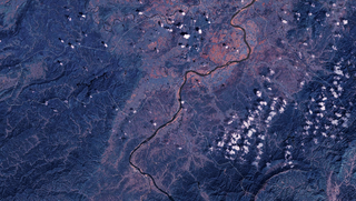
English: Satellite Image of Taihe County, China
中文:泰和县卫星图像 |
| Source | NASA Landsat7 |
| Author | NASA |
Licensing
[edit]
| This file is in the public domain in the United States because it was solely created by NASA. NASA copyright policy states that "NASA material is not protected by copyright unless noted". (See Template:PD-USGov, NASA copyright policy page or JPL Image Use Policy.) | ||
 |
Warnings:
|
File history
Click on a date/time to view the file as it appeared at that time.
| Date/Time | Thumbnail | Dimensions | User | Comment | |
|---|---|---|---|---|---|
| current | 13:31, 24 March 2009 | | 2,552 × 1,442 (6 MB) | Camphora (talk | contribs) | 投影由 Geographic 改为 UTM |
| 01:31, 13 March 2009 |  | 2,552 × 1,336 (6.77 MB) | Camphora (talk | contribs) | 调整曝光 | |
| 07:26, 1 March 2009 |  | 2,552 × 1,336 (5.13 MB) | Camphora (talk | contribs) | {{Information |Description={{en|1=Satellite Image of Taihe County, China }} {{zh|1=泰和县卫星图像}} |Source=NASA Landsat7 |Author=NASA |Date= |Permission= |other_versions= }} Category:satellites Category:Geography of Jiangxi [[Category:Land |
You cannot overwrite this file.
File usage on Commons
The following 13 pages use this file:
- 江西
- User:Camphora
- Category:Airports in Jiangxi
- Category:Bridges in Jiangxi
- Category:Flora of Jiangxi
- Category:Geography of Jiangxi
- Category:Jiangxi
- Category:Lakes of Jiangxi
- Category:Maps of Jiangxi
- Category:People of Jiangxi
- Category:Rail transport in Jiangxi
- Category:Transport in Jiangxi
- Category:Views of Jiangxi
File usage on other wikis
The following other wikis use this file:
- Usage on ar.wikipedia.org
- Usage on ast.wikipedia.org
- Usage on az.wikipedia.org
- Usage on be.wikipedia.org
- Usage on ca.wikipedia.org
- Usage on ce.wikipedia.org
- Usage on cy.wikipedia.org
- Usage on de.wikipedia.org
- Usage on de.wikivoyage.org
- Usage on el.wikipedia.org
- Usage on eu.wikipedia.org
- Usage on fi.wikipedia.org
- Usage on fr.wikivoyage.org
- Usage on ga.wikipedia.org
- Usage on hy.wikipedia.org
- Usage on ia.wikipedia.org
- Usage on ka.wikipedia.org
- Usage on lmo.wikipedia.org
- Usage on mzn.wikipedia.org
- Usage on nn.wikipedia.org
- Usage on no.wikipedia.org
- Usage on pl.wikipedia.org
- Usage on ro.wikipedia.org
- Usage on ru.wikipedia.org
- Usage on ru.wikinews.org
- Usage on sr.wikipedia.org
- Usage on tg.wikipedia.org
- Usage on tl.wikipedia.org
- Usage on vec.wikipedia.org
- Usage on vi.wikipedia.org
- Usage on www.wikidata.org