File:SatLandBremen.jpg
Jump to navigation
Jump to search

Size of this preview: 366 × 599 pixels. Other resolutions: 146 × 240 pixels | 552 × 904 pixels.
Original file (552 × 904 pixels, file size: 259 KB, MIME type: image/jpeg)
Captions
Captions
Add a one-line explanation of what this file represents
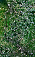
- Satellitenaufnahme von Bremerhaven und Bremen
- from Nasa World Wind - Free Satellite Image
| This image is in the public domain because it is a screenshot from NASA’s globe software World Wind using a public domain layer, such as Blue Marble, MODIS, Landsat, SRTM, USGS or GLOBE.
|
 |
File history
Click on a date/time to view the file as it appeared at that time.
| Date/Time | Thumbnail | Dimensions | User | Comment | |
|---|---|---|---|---|---|
| current | 12:10, 19 December 2005 | | 552 × 904 (259 KB) | Godewind (talk | contribs) | * Satellitenaufnahme von Bremerhaven und Bremen * from Nasa World Wind - Free Satellite Image {{PD-USGov}} Category:Satellite photos Category:Bremerhaven, Germany Category:Bremen, Germany |
You cannot overwrite this file.
File usage on Commons
There are no pages that use this file.
File usage on other wikis
The following other wikis use this file:
- Usage on de.wikipedia.org
- Usage on zh.wikipedia.org