File:Sao Francisco River and Sobradinho Reservoir (MODIS 2022-06-11).jpg
Jump to navigation
Jump to search

Size of this preview: 759 × 600 pixels. Other resolutions: 304 × 240 pixels | 608 × 480 pixels | 972 × 768 pixels | 1,280 × 1,012 pixels | 1,545 × 1,221 pixels.
Original file (1,545 × 1,221 pixels, file size: 1.01 MB, MIME type: image/jpeg)
Captions
Captions
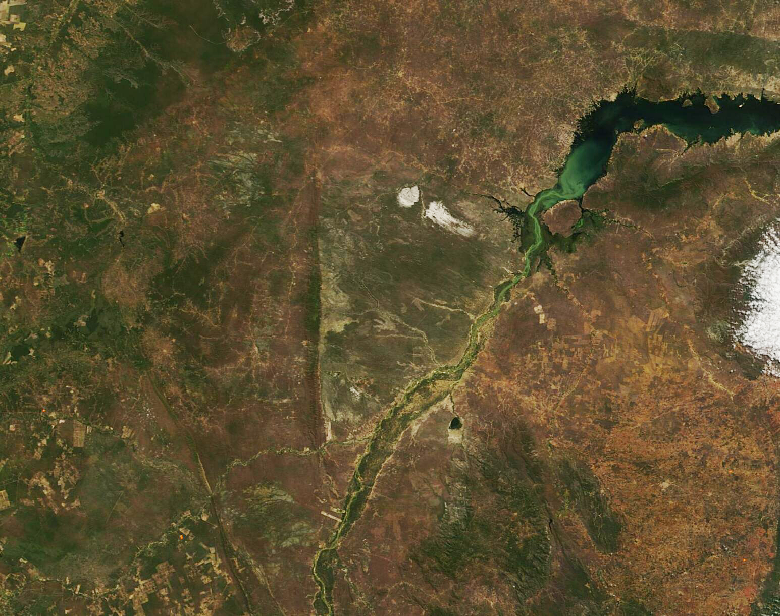
On June 7, 2022, the Moderate Resolution Imaging Spectroradiometer (MODIS) on board NASA’s Terra satellite acquire a true-color image capturing much of the São Francisco River and the Sobradinho Reservoir.
Summary
[edit].jpg&action=edit§ion=1)
| Description |
English: The São Francisco River is the fourth-largest river system in South America as well as the longest river that stays within the country of Brazil. The roughly 1,800-mile (2,900-km) long river starts in the Canastra mountains of the Brazilian highlands, then flows north and east through the Brazilian sertão before expanding behind a major dam to form the Sobradinho Reservoir. Ultimately, water from the São Francisco River pours into the Atlantic Ocean. The massive Sobradinho Reservoir ranks as the fifteenth-largest reservoir in the world and the dam, which was completed in 1982, generates more than 60 percent of Brazil’s energy needs.
On June 7, 2022, the Moderate Resolution Imaging Spectroradiometer (MODIS) on board NASA’s Terra satellite acquire a true-color image capturing much of the São Francisco River and the Sobradinho Reservoir. The green color seen in the river and spilling into the southern waters of the reservoir is most likely sediment washed into the river as it traverses the semi-arid sertão region that makes up much of the São Francisco River basin. The sertão is an inland, semi-desert land of filled with rock and cactus, and also of broken highlands. It is sparsely populated, thanks primarily to unpredictable and scarce rain, which can be absent for years in some places. Where the São Francisco River snakes through the sertão, villages and towns have sprung up. Some of the hills of the São Francisco River basin hold a wealth of gold and emeralds and have supported mining for nearly 300 years. |
||
| Date | Taken on 7 June 2022 | ||
| Source |
Sao Francisco River and Sobradinho Reservoir (direct link)
|
||
| Author | MODIS Land Rapid Response Team, NASA GSFC |
| This media is a product of the Terra mission Credit and attribution belongs to the mission team, if not already specified in the "author" row |
Licensing
[edit].jpg&action=edit§ion=2)
| This file is in the public domain in the United States because it was solely created by NASA. NASA copyright policy states that "NASA material is not protected by copyright unless noted". (See Template:PD-USGov, NASA copyright policy page or JPL Image Use Policy.) | ||
 |
Warnings:
|
File history
Click on a date/time to view the file as it appeared at that time.
| Date/Time | Thumbnail | Dimensions | User | Comment | |
|---|---|---|---|---|---|
| current | 22:01, 9 January 2024 | | 1,545 × 1,221 (1.01 MB) | OptimusPrimeBot (talk | contribs) | #Spacemedia - Upload of http://modis.gsfc.nasa.gov/gallery/images/image06112022_250m.jpg via Commons:Spacemedia |
You cannot overwrite this file.
File usage on Commons
There are no pages that use this file.
.jpg&oldid=840278390)