File:Santa Fe route. LOC 98687168.jpg
Jump to navigation
Jump to search

Size of this preview: 800 × 256 pixels. Other resolutions: 320 × 102 pixels | 640 × 205 pixels | 1,024 × 327 pixels | 1,280 × 409 pixels | 2,560 × 818 pixels | 14,665 × 4,688 pixels.
Original file (14,665 × 4,688 pixels, file size: 9.99 MB, MIME type: image/jpeg)
Captions
Captions
Add a one-line explanation of what this file represents
Summary
[edit]| Description |
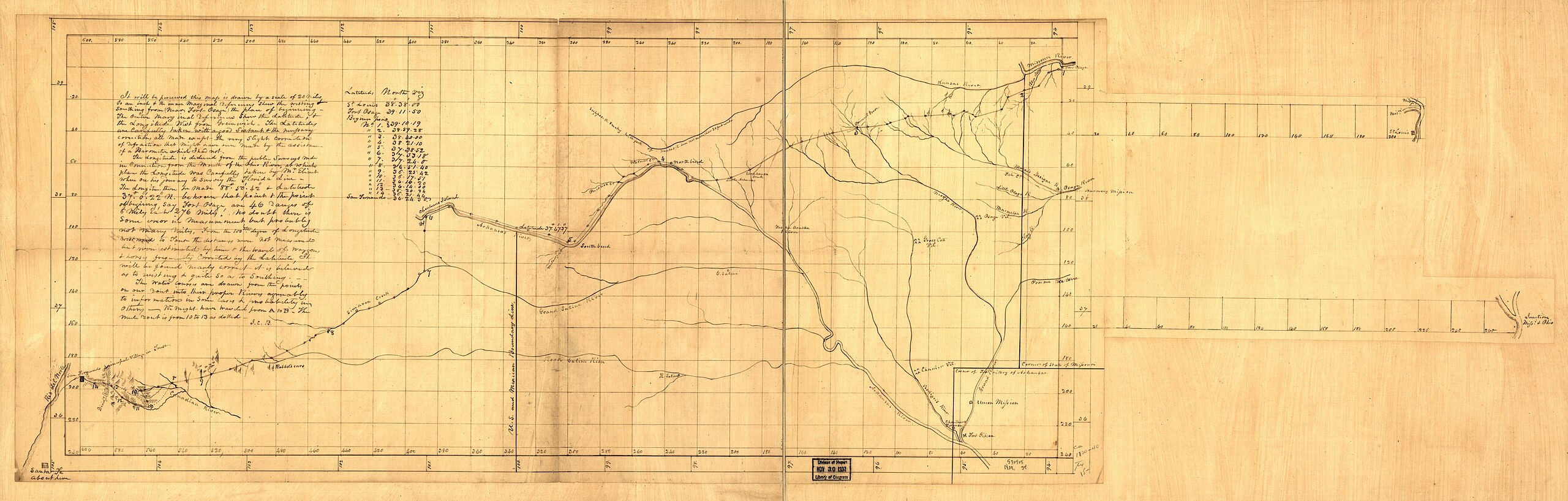
English: Pen and ink. Commissioned by Pres. Monroe, March 3, 1825 to survey and mark the Santa Fe Road. Report of survey completed 1827. Map belonged to Mjr. George C. Sibley, one of the U.S. Commissioners who conducted the survey. Available also through the Library of Congress web site as a raster image. Vault |
||
| Title | [Santa Fe route]. | ||
| Shelf ID | G4052.S3 1825 .B7 TIL | ||
| Date | |||
| Source | https://www.loc.gov/item/98687168/ | ||
| Author | Brown, J. C. (Joseph C.); Sibley, George Champlin; Brown, J. C. | ||
| Permission (Reusing this file) |
|
||
| Other versions |
|
||
| Location | United States · Santa Fe Trail · Santa Fe National Historic Trail | ||
| Part of | American Memory · Catalog · Transportation And Communication · Geography And Map Division | ||
| Subject | United States · Maps · Santa Fe Trail · Santa Fe National Historic Trail |

Licensing
[edit]
|
This is a faithful photographic reproduction of a two-dimensional, public domain work of art. The work of art itself is in the public domain for the following reason:
The official position taken by the Wikimedia Foundation is that "faithful reproductions of two-dimensional public domain works of art are public domain".
This photographic reproduction is therefore also considered to be in the public domain in the United States. In other jurisdictions, re-use of this content may be restricted; see Reuse of PD-Art photographs for details. | ||||
File history
Click on a date/time to view the file as it appeared at that time.
| Date/Time | Thumbnail | Dimensions | User | Comment | |
|---|---|---|---|---|---|
| current | 04:19, 30 May 2018 | 14,665 × 4,688 (9.99 MB) | Fæ (talk | contribs) | LOC Maps https://www.loc.gov/item/98687168/ #15399 |
You cannot overwrite this file.
File usage on Commons
The following 3 pages use this file:
._LOC_98687168.jpg&redirect=no)