File:Sandy 2012-10-29 1515Z.png
Jump to navigation
Jump to search

Size of this preview: 800 × 450 pixels. Other resolutions: 320 × 180 pixels | 640 × 360 pixels | 1,024 × 576 pixels | 1,280 × 720 pixels | 1,920 × 1,080 pixels.
Original file (1,920 × 1,080 pixels, file size: 2.07 MB, MIME type: image/png)
Captions
Captions
Add a one-line explanation of what this file represents
Summary
[edit]
| Description |
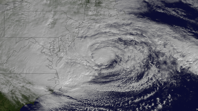
English: Hurricane Sandy, with winds of 90 mph and heavy rains, is creating dangerous flooding conditions all along the Northeast U.S. from NC to New England. This NOAA GOES-13 satellite image taken on October 29, 2012 shows the storm as it is centered off of Maryland and Virginia. The storm is heading in a northwestern direction towards the Delaware and southern New Jersey coast. |
| Date | |
| Source | http://www.nnvl.noaa.gov/MediaDetail2.php?MediaID=1223&MediaTypeID=1 |
| Author | The National Oceanic and Atmospheric Administration |
Licensing
[edit]
This image is in the public domain because it contains materials that originally came from the U.S. National Oceanic and Atmospheric Administration, taken or made as part of an employee's official duties.
|
File history
Click on a date/time to view the file as it appeared at that time.
| Date/Time | Thumbnail | Dimensions | User | Comment | |
|---|---|---|---|---|---|
| current | 08:27, 9 April 2018 | | 1,920 × 1,080 (2.07 MB) | A1Cafel (talk | contribs) | remove logo |
| 20:22, 29 October 2012 |  | 1,920 × 1,080 (1.93 MB) | Supportstorm (talk | contribs) | {{Information |Description ={{en|1=Hurricane Sandy, with winds of 90 mph and heavy rains, is creating dangerous flooding conditions all along the Northeast U.S. from NC to New England. This NOAA GOES-13 satellite image taken on October 29, 2012 show... |
You cannot overwrite this file.
File usage on Commons
The following 3 pages use this file:
- Commons:WikiProject Aviation/recent uploads/2018 April 9
- File:Sandy Oct 29 2012 1515Z.png (file redirect)
- File:Sandy Oct 29 2012 1540Z.png (file redirect)
File usage on other wikis
The following other wikis use this file:
- Usage on el.wikipedia.org
- Usage on fr.wikipedia.org
- Usage on sr.wikinews.org