File:Sanborn Fire Insurance Map from Woonsocket, Sanborn County, South Dakota. LOC sanborn08278 001.jpg
Jump to navigation
Jump to search

Size of this preview: 506 × 599 pixels. Other resolutions: 203 × 240 pixels | 405 × 480 pixels | 649 × 768 pixels | 865 × 1,024 pixels | 1,730 × 2,048 pixels | 6,510 × 7,707 pixels.
Original file (6,510 × 7,707 pixels, file size: 3.61 MB, MIME type: image/jpeg)
Captions
Captions
Add a one-line explanation of what this file represents
Summary
[edit]| Description |
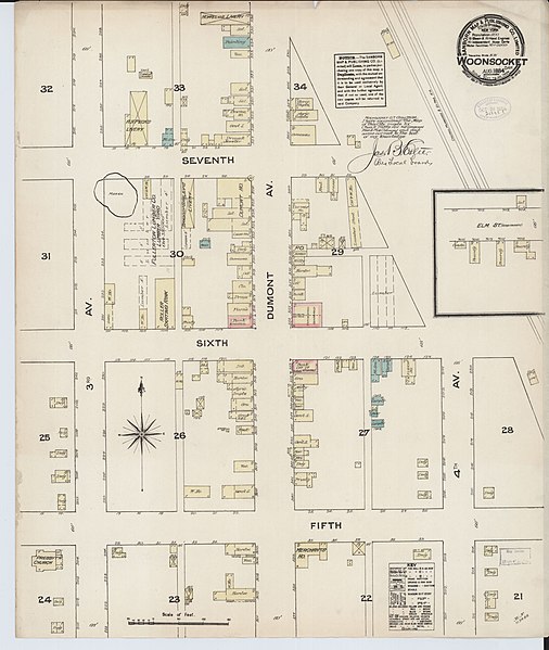
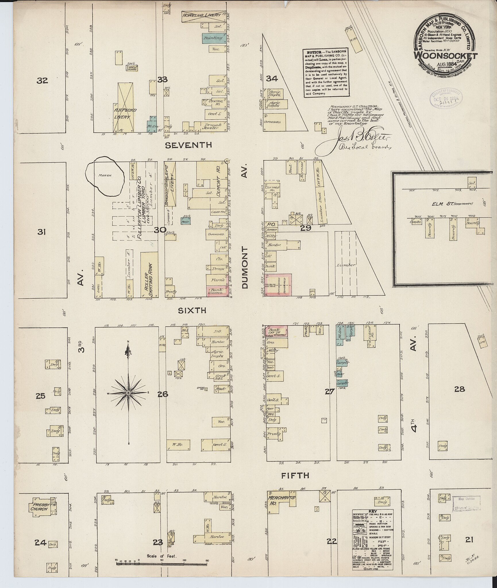
English: Aug 1884. 1 Sheet(s). |
||
| Title | Sanborn Fire Insurance Map from Woonsocket, Sanborn County, South Dakota. | ||
| Shelf ID | https://www.loc.gov/item/sanborn08278_001/ | ||
| Date | |||
| Source | https://www.loc.gov/item/sanborn08278_001/ | ||
| Author | Unknown author | ||
| Permission (Reusing this file) |
|
||
| Other versions |
|
||
| Location | Woonsocket · South Dakota · Sanborn County | ||
| Part of | American Memory · Sanborn Maps · Geography And Maps Division · Sanborn Fire Insurance Maps |

Licensing
[edit]
|
This is a faithful photographic reproduction of a two-dimensional, public domain work of art. The work of art itself is in the public domain for the following reason:
The official position taken by the Wikimedia Foundation is that "faithful reproductions of two-dimensional public domain works of art are public domain".
This photographic reproduction is therefore also considered to be in the public domain in the United States. In other jurisdictions, re-use of this content may be restricted; see Reuse of PD-Art photographs for details. | ||||
File history
Click on a date/time to view the file as it appeared at that time.
| Date/Time | Thumbnail | Dimensions | User | Comment | |
|---|---|---|---|---|---|
| current | 03:17, 26 May 2018 | | 6,510 × 7,707 (3.61 MB) | Fæ (talk | contribs) | LOC Maps https://www.loc.gov/item/sanborn08278_001/ #1450 |
You cannot overwrite this file.
File usage on Commons
The following page uses this file: