File:Sanborn 1893-1903 Seattle map 3 right - 01.jpg
Jump to navigation
Jump to search
Size of this preview: 435 × 599 pixels. Other resolutions: 174 × 240 pixels | 349 × 480 pixels | 558 × 768 pixels | 744 × 1,024 pixels | 2,282 × 3,141 pixels.
Original file (2,282 × 3,141 pixels, file size: 1.43 MB, MIME type: image/jpeg)
Captions
Captions
Add a one-line explanation of what this file represents
Summary
[edit]
| Description |
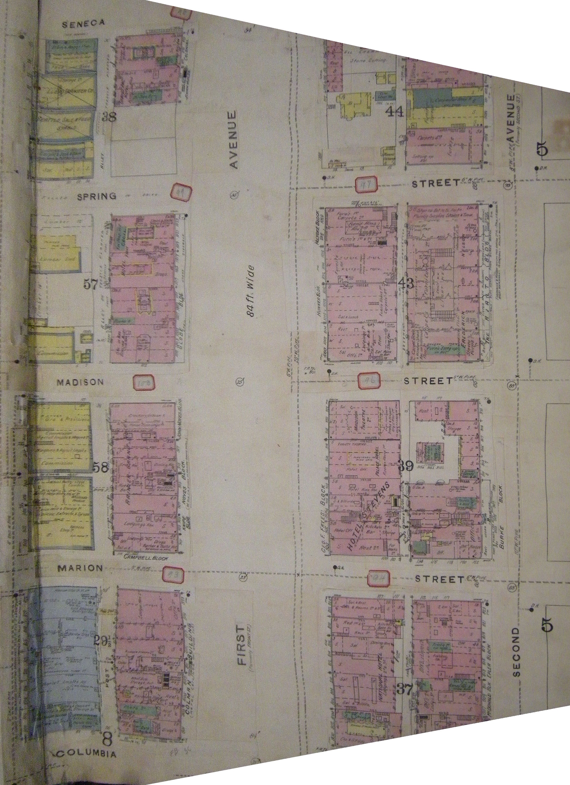
Part of plate Plate 3, Insurance Maps of Seattle, Washington, Volume 1, Sanborn Map Company, 1893, updated to 1903. This image is downtown, from Columbia St. to Seneca St., from Western Avenue to Second Avenue. The Rialto Building, between Madison and Spring on Second, housed Frederick & Nelson department store at the time. Only a few of the buildings shown here survive as of 2008. Two that do are the Colman Building and the Holyoke Block. Copied by taking a photograph of a page in a copy of the book at Seattle Public Library (Seattle Room of the Central Library); image cleaned up using GIMP, mainly using the perspective transform feature, but also unsharp mask. |
| Date | from 1893 until 1903 |
| Source | Plate 3, Insurance Maps of Seattle, Washington, Volume 1, Sanborn Map Company, 1893, updated to 1903 |
| Author | Sanborn Map Company |
| Permission (Reusing this file) |
PD-US |
| Other versions | Image:Sanborn 1893-1903 Seattle map 3 right detail - 01.jpg shows one block of this, the block that then included the Burke Building and now contains the Henry M. Jackson Federal Building. |
Licensing
[edit]
This media file is in the public domain in the United States. This applies to U.S. works where the copyright has expired, often because its first publication occurred prior to January 1, 1929, and if not then due to lack of notice or renewal. See this page for further explanation.
|
 | |
 |
File history
Click on a date/time to view the file as it appeared at that time.
| Date/Time | Thumbnail | Dimensions | User | Comment | |
|---|---|---|---|---|---|
| current | 08:04, 22 March 2008 | | 2,282 × 3,141 (1.43 MB) | Jmabel (talk | contribs) | == Summary == {{Information |Description=Part of plate Plate 3, ''Insurance Maps of Seattle, Washington'', Volume 1, Sanborn Map Company, 1893, updated to 1903. This image is downtown, from Columbia St. to Seneca St., from Western Avenue to Second Avenu |
You cannot overwrite this file.
File usage on Commons
There are no pages that use this file.