File:Sanborn 1893-1903 Seattle map 2 left - 01.jpg
Original file (2,250 × 3,036 pixels, file size: 1.38 MB, MIME type: image/jpeg)
Captions
Captions
Summary
[edit]
| Description |
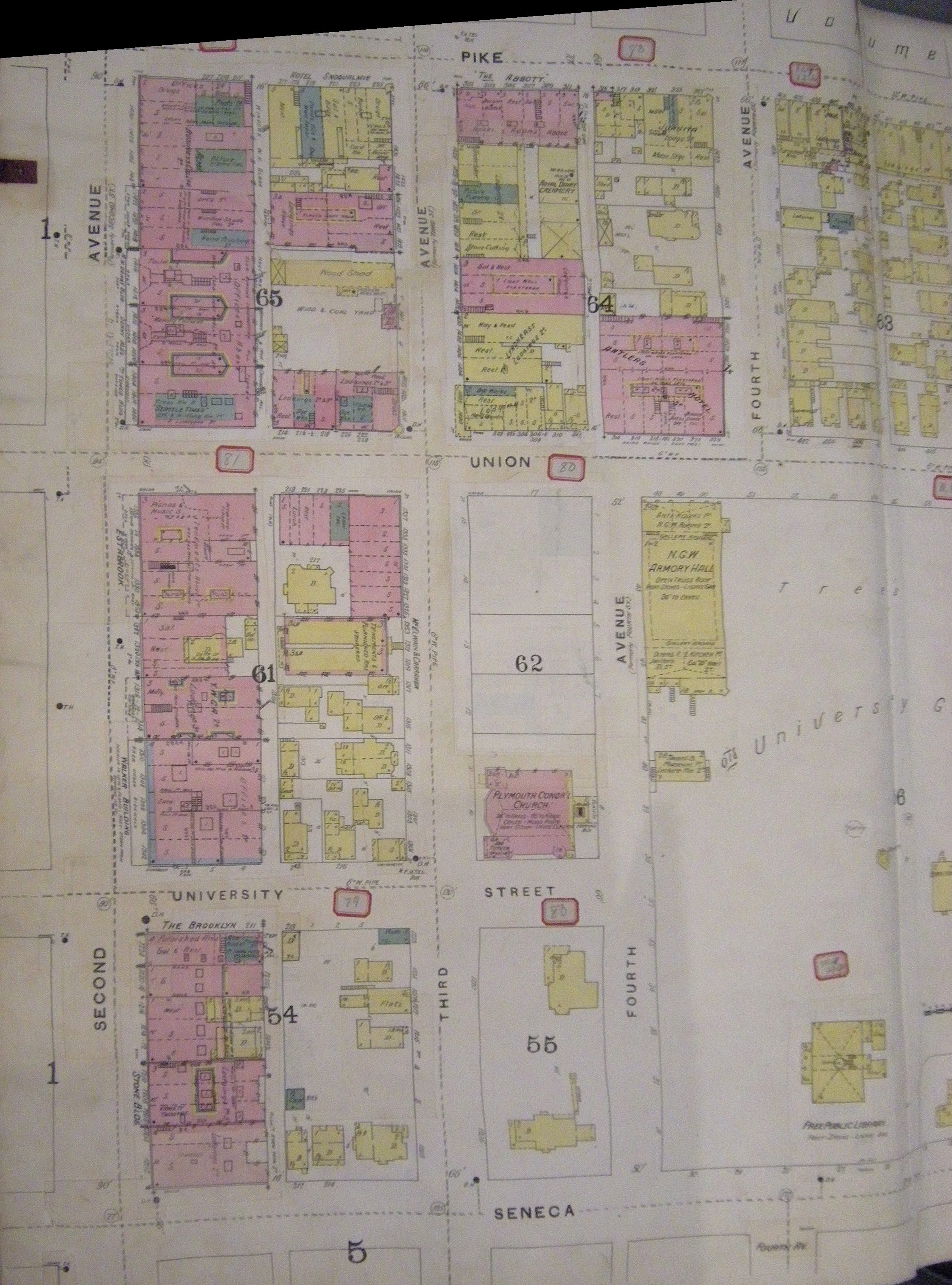
Part of plate Plate 2, Insurance Maps of Seattle, Washington, Volume 1, Sanborn Map Company, 1893, updated to 1903. This image is in the north part of downtown, from 2nd Avenue to slightly east of 4th Avenue and from Seneca Street to Pike Street. It includes much of the original University of Washington Campus (now the Metropolitan Tract). At the northeast corner of 2nd and Union was the office at the time of the Seattle Times. Few buildings from this period survive in this area of town. Among the few that do is the Brooklyn (southeast corner of 2nd and University). Copied by taking a photograph of a page in a copy of the book at Seattle Public Library (Seattle Room of the Central Library); image cleaned up using GIMP, mainly using the perspective transform feature. |
| Date | Originally printed/published 1893, updated to reflect changes from then till 1903 |
| Source | Plate 2, Insurance Maps of Seattle, Washington, Volume 1, Sanborn Map Company, 1893, updated to 1903 |
| Author | Sanborn Map Company |
| Permission (Reusing this file) |
PD-US |
Licensing
[edit]
This media file is in the public domain in the United States. This applies to U.S. works where the copyright has expired, often because its first publication occurred prior to January 1, 1929, and if not then due to lack of notice or renewal. See this page for further explanation.
|
 | |
 |
File history
Click on a date/time to view the file as it appeared at that time.
| Date/Time | Thumbnail | Dimensions | User | Comment | |
|---|---|---|---|---|---|
| current | 07:47, 22 March 2008 | | 2,250 × 3,036 (1.38 MB) | Jmabel (talk | contribs) | == Summary == {{Information |Description=Part of plate Plate 1, ''Insurance Maps of Seattle, Washington'', Volume 1, Sanborn Map Company, 1904. This image is in the north part of downtown, from 2nd Avenue to 4th Avenue and from Seneca Street to Pike Str |
You cannot overwrite this file.
File usage on Commons
There are no pages that use this file.