File:San Pedro Riparian NCA 3.jpg
![File:San Pedro Riparian NCA 3.jpg](https://upload.wikimedia.org/wikipedia/commons/thumb/4/41/San_Pedro_Riparian_NCA_3.jpg/800px-San_Pedro_Riparian_NCA_3.jpg?20140225084331)
Original file (5,616 × 3,744 pixels, file size: 9.49 MB, MIME type: image/jpeg)
Captions
Captions
DescriptionSan Pedro Riparian NCA 3.jpg |
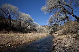
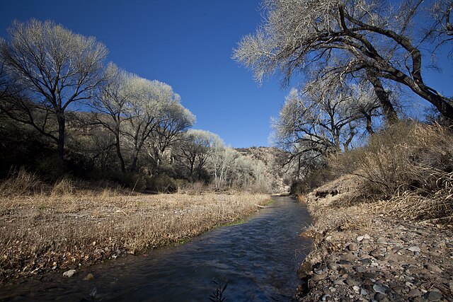
The San Pedro Riparian National Conservation Area contains nearly 57,000 acres of public land in Cochise County, Arizona, between the international border and St. David, Arizona. Photos: Bob Wick, BLM California |
||
Date | |||
Source | Flickr: San Pedro Riparian NCA | ||
Author | Bureau of Land Management | ||
Permission (Reusing this file) |
![]() ![]() This file is licensed under the Creative Commons Attribution 2.0 Generic license.
|
File history
Click on a date/time to view the file as it appeared at that time.
Date/Time | Thumbnail | Dimensions | User | Comment | |
---|---|---|---|---|---|
current | 08:43, 25 February 2014 | ![]() | 5,616 × 3,744 (9.49 MB) | Flickr upload bot (talk | contribs) | Uploaded from http://flickr.com/photo/91981596@N06/9407206190 using Flickr upload bot |
You cannot overwrite this file.
File usage on Commons
The following 2 pages use this file:
File usage on other wikis
The following other wikis use this file:
- Usage on ceb.wikipedia.org
- Usage on en.wikipedia.org
- Usage on en.wikivoyage.org
- Usage on es.wikipedia.org
- Usage on es.wikivoyage.org
- Usage on www.wikidata.org
Metadata
This file contains additional information such as Exif metadata which may have been added by the digital camera, scanner, or software program used to create or digitize it. If the file has been modified from its original state, some details such as the timestamp may not fully reflect those of the original file. The timestamp is only as accurate as the clock in the camera, and it may be completely wrong.
Camera manufacturer | Canon |
---|---|
Camera model | Canon EOS 5D Mark II |
Author | robert wick |
Exposure time | 1/15 sec (0.066666666666667) |
F-number | f/22 |
ISO speed rating | 125 |
Date and time of data generation | 09:42, 8 January 2010 |
Lens focal length | 17 mm |
Usage terms |
|
Horizontal resolution | 300 dpi |
Vertical resolution | 300 dpi |
File change date and time | 13:59, 26 January 2010 |
Exposure Program | Manual |
Exif version | 2.21 |
Date and time of digitizing | 09:42, 8 January 2010 |
APEX shutter speed | 3.906891 |
APEX aperture | 8.918863 |
APEX exposure bias | 0 |
Maximum land aperture | 4 APEX (f/4) |
Subject distance | 3.72 meters |
Metering mode | Pattern |
Flash | Flash did not fire, compulsory flash suppression |
DateTimeOriginal subseconds | 27 |
DateTimeDigitized subseconds | 27 |
Focal plane X resolution | 3,849.2117888965 |
Focal plane Y resolution | 3,908.1419624217 |
Focal plane resolution unit | inches |
Custom image processing | Normal process |
Exposure mode | Manual exposure |
White balance | Auto white balance |
Scene capture type | Standard |
Width | 5,616 px |
Height | 3,744 px |
Image width | 5,616 px |
Image height | 3,744 px |
Serial number of camera | 320103926 |
Lens used | EF17-40mm f/4L USM |
Date metadata was last modified | 01:25, 26 January 2010 |
Rating (out of 5) | 3 |
Software used | Adobe Photoshop Lightroom |
Copyright status | Copyright status not set |
Contact information | rwick@blm.gov
Bureau of Land Management Arcata Field Office 1695 Heindon Rd., Arcata, CA , 95521 usa |
Keywords |
|
IIM version | 2 |