File:San Miguel Cemetery, Málaga 13.jpg
Jump to navigation
Jump to search
Size of this preview: 450 × 600 pixels. Other resolutions: 180 × 240 pixels | 360 × 480 pixels | 576 × 768 pixels | 768 × 1,024 pixels | 1,536 × 2,048 pixels | 3,456 × 4,608 pixels.
Original file (3,456 × 4,608 pixels, file size: 3.52 MB, MIME type: image/jpeg)
Captions
Captions
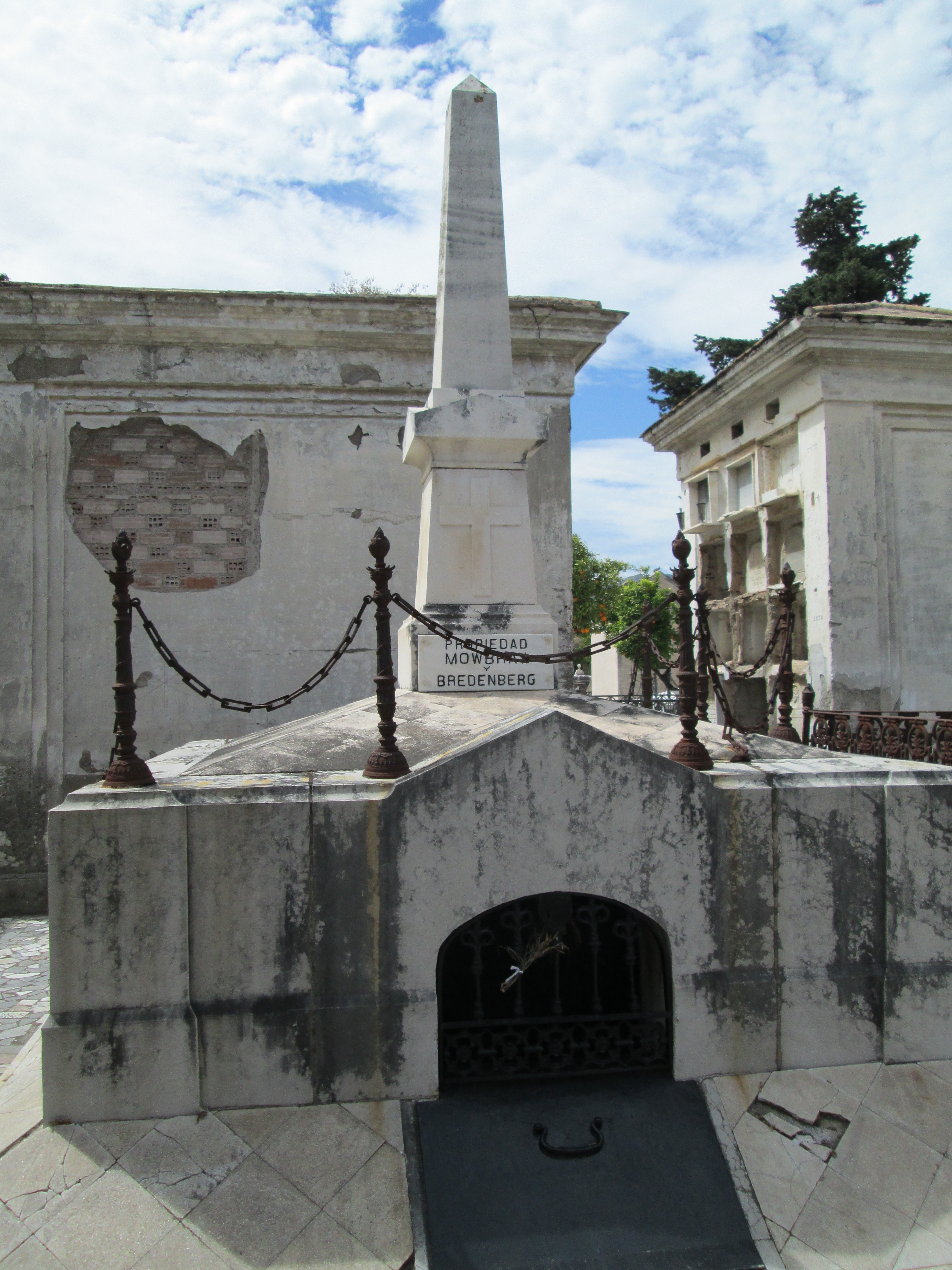
Mowbray and Bredenber Pantheon, in Calle de la Verónica, garden no. 3, San Miguel Cemetery, Málaga, Spain.
Summary
[edit]
| Description |
Español: Panteón Mowbray y Bredenber, en la calle de la Verónica, jardín n.º 3, cementerio de San Miguel, Málaga, España. Se trata de una bóveda subterránea (cripta) propiedad de los descendientes de Daniel Mowbray, marino inglés nacido en Newcastle, y Julius Bredenberg, marino sueco nacido en Sundsvall. Ambos se establecieron en Málaga a mediados del siglo XIX, desarrollando actividades comerciales de importación y exportación. Los dos están enterrados en el Cementerio Inglés. La unión de ambas familias se realizó a través del matrimonio entre Pedro Bredenberg Isasi, hijo de Julius, y Clara Mowbray de la Torre, nieta de Daniel. Este matrimonio y algunos de sus descendientes están enterrado en el panteón de San Miguel.[1] English: Mowbray and Bredenber Pantheon, in Calle de la Verónica, garden no. 3, San Miguel Cemetery, Málaga, Spain. This is an underground vault (crypt) owned by the descendants of Daniel Mowbray, an English sailor born in Newcastle, and Julius Bredenberg, a Swedish sailor born in Sundsvall. Both settled in Malaga in the mid-19th century, carrying out import and export trading activities. Both are buried in the English Cemetery. The union of the two families took place with the marriage between Pedro Bredenberg Isasi, son of Julius, and Clara Mowbray de la Torre, granddaughter of Daniel. This couple is buried in the pantheon of San Miguel, as well as some of their descendants.[2] |
| Date | |
| Source | Own work |
| Author | Tyk |
| Openstreetmap entry | Link to Openstreetmap |
| Camera location | | View this and other nearby images on: OpenStreetMap |
|---|
| Object location | | View this and other nearby images on: OpenStreetMap |
|---|
Licensing
[edit]
I, the copyright holder of this work, hereby publish it under the following license:
This file is licensed under the Creative Commons Attribution-Share Alike 3.0 Unported license.
- You are free:
- to share – to copy, distribute and transmit the work
- to remix – to adapt the work
- Under the following conditions:
- attribution – You must give appropriate credit, provide a link to the license, and indicate if changes were made. You may do so in any reasonable manner, but not in any way that suggests the licensor endorses you or your use.
- share alike – If you remix, transform, or build upon the material, you must distribute your contributions under the same or compatible license as the original.
File history
Click on a date/time to view the file as it appeared at that time.
| Date/Time | Thumbnail | Dimensions | User | Comment | |
|---|---|---|---|---|---|
| current | 11:37, 17 August 2013 | | 3,456 × 4,608 (3.52 MB) | Tyk (talk | contribs) | User created page with UploadWizard |
You cannot overwrite this file.
File usage on Commons
The following page uses this file: