File:San Benito Sectores 2.PNG
Jump to navigation
Jump to search

Size of this preview: 800 × 557 pixels. Other resolutions: 320 × 223 pixels | 640 × 445 pixels | 1,024 × 712 pixels | 1,280 × 890 pixels | 1,646 × 1,145 pixels.
Original file (1,646 × 1,145 pixels, file size: 169 KB, MIME type: image/png)
Captions
Captions
Add a one-line explanation of what this file represents
Summary
[edit]
| Description |
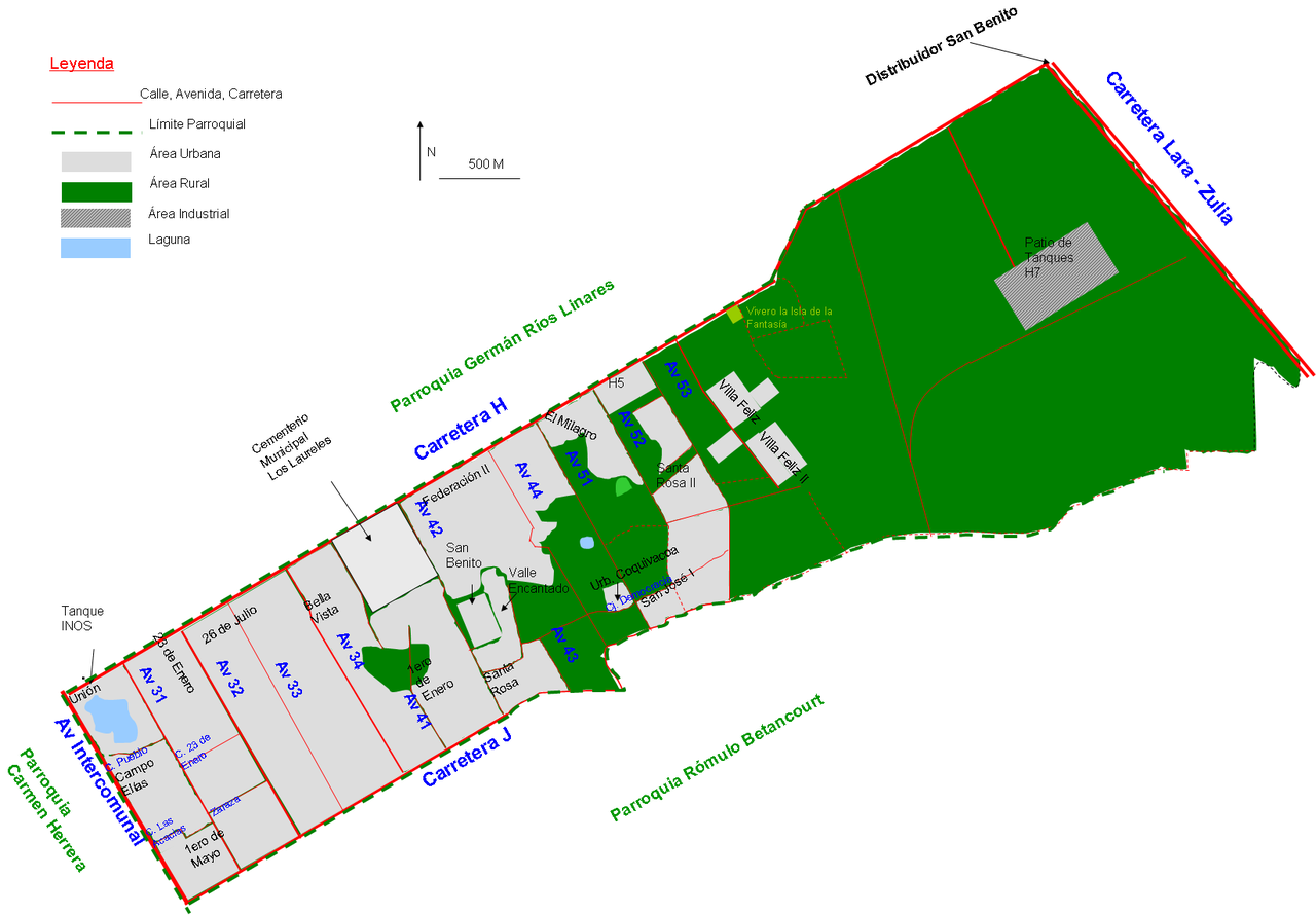
Español: Detalle de la parroquia San Benito con los sectores que lo componen en la ciudad de Cabimas, estado Zulia, Venezuela |
| Date | |
| Source | Own work |
| Author | Andrés González |
Licensing
[edit]
| I, the copyright holder of this work, release this work into the public domain. This applies worldwide. In some countries this may not be legally possible; if so: I grant anyone the right to use this work for any purpose, without any conditions, unless such conditions are required by law. |
File history
Click on a date/time to view the file as it appeared at that time.
| Date/Time | Thumbnail | Dimensions | User | Comment | |
|---|---|---|---|---|---|
| current | 02:43, 6 February 2013 | | 1,646 × 1,145 (169 KB) | Andrés González (talk | contribs) | Añadido sector Coquivacoa, ampliado el perímetro de Villa Feliz, cambiados los símbolos de área industrial y límite parroquial |
| 14:25, 8 February 2011 |  | 1,065 × 759 (88 KB) | Andrés González (talk | contribs) | Mapa mejorado con mas sectores, mas detalles, lagunas, escala, leyenda, y mejor polígono | |
| 15:10, 17 July 2008 |  | 935 × 749 (65 KB) | Andrés González (talk | contribs) | {{Information |Description={{es|1=Detalle de la parroquia San Benito con los sectores que lo componen en la ciudad de Cabimas, estado Zulia, Venezuela}} |Source=Own work by uploader |Author=Andrés González |Date=17/07/2008 |Pe |
You cannot overwrite this file.
File usage on Commons
There are no pages that use this file.
File usage on other wikis
The following other wikis use this file:
- Usage on es.wikipedia.org