File:Samuel Wallis map of Boscawen and Keppel islands (Tafahi and Niuatoputapu).jpg
Jump to navigation
Jump to search
Size of this preview: 569 × 599 pixels. Other resolutions: 228 × 240 pixels | 456 × 480 pixels | 729 × 768 pixels | 972 × 1,024 pixels | 2,339 × 2,464 pixels.
Original file (2,339 × 2,464 pixels, file size: 2.51 MB, MIME type: image/jpeg)
Captions
Captions
Add a one-line explanation of what this file represents
Summary
[edit].jpg&action=edit§ion=1)
| Description |
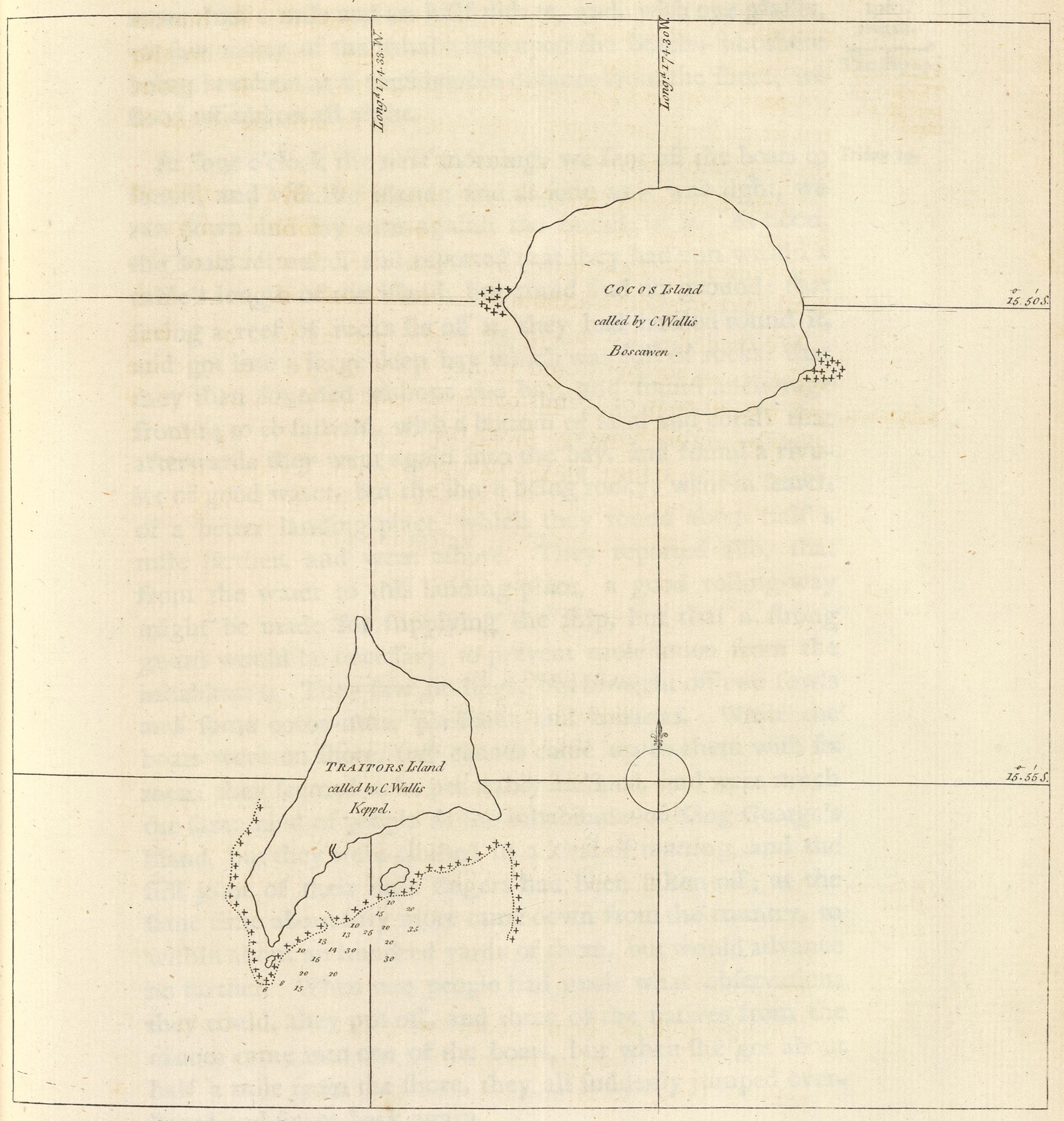
English: Map drawn by Samuel Wallis of Boscawen (Tafahi) and Admiral Keppel's island (Niuatoputapu), in Tonga.
Français : Carte dessinée par le capitaine Samuel Wallis représentant l'île de Boscawen (Tafahi) et de l'Amiral Keppel (Niuatoputapu), aux Tonga. |
| Date | |
| Source | http://www.davidrumsey.com/luna/servlet/detail/RUMSEY~8~1~23981~870026:-Cocos-Island-called-by-C--Wallis-B# |
| Author | John Hawkesworth (1715-1773), Samuel Wallis (1728-1795) |
Licensing
[edit].jpg&action=edit§ion=2)
|
This work is in the public domain in its country of origin and other countries and areas where the copyright term is the author's life plus 70 years or fewer. This work is in the public domain in the United States because it was published (or registered with the U.S. Copyright Office) before January 1, 1929. | |
| This file has been identified as being free of known restrictions under copyright law, including all related and neighboring rights. | |
File history
Click on a date/time to view the file as it appeared at that time.
| Date/Time | Thumbnail | Dimensions | User | Comment | |
|---|---|---|---|---|---|
| current | 15:22, 16 August 2017 | | 2,339 × 2,464 (2.51 MB) | Skimel (talk | contribs) | User created page with UploadWizard |
You cannot overwrite this file.
File usage on Commons
There are no pages that use this file.
.jpg&oldid=855575398)