File:Samuel P. Brown House.jpg
Jump to navigation
Jump to search
Size of this preview: 800 × 600 pixels. Other resolutions: 320 × 240 pixels | 640 × 480 pixels | 1,024 × 768 pixels | 1,280 × 960 pixels | 2,560 × 1,920 pixels | 2,816 × 2,112 pixels.
Original file (2,816 × 2,112 pixels, file size: 2.78 MB, MIME type: image/jpeg)
Captions
Captions
Add a one-line explanation of what this file represents
|
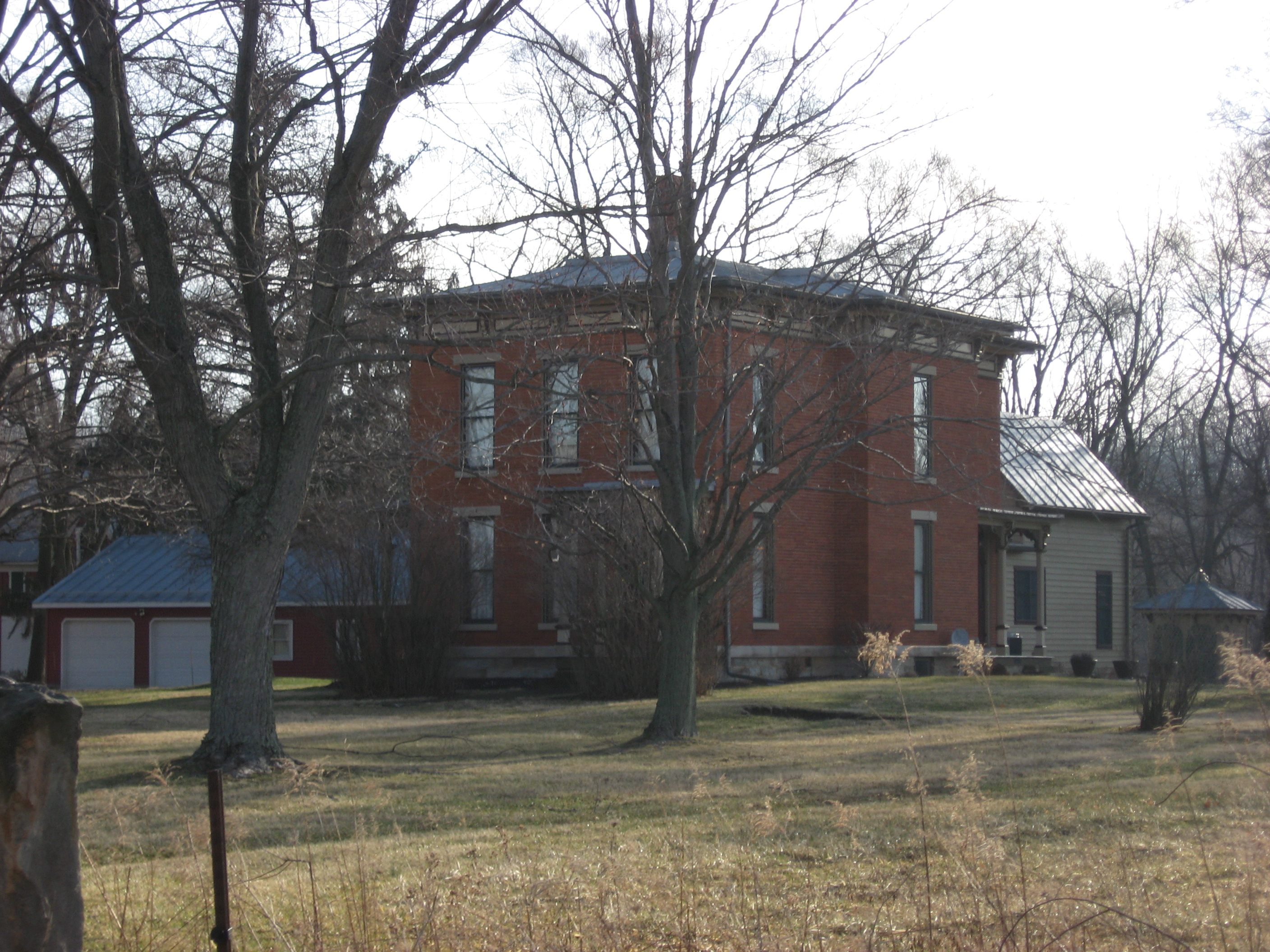
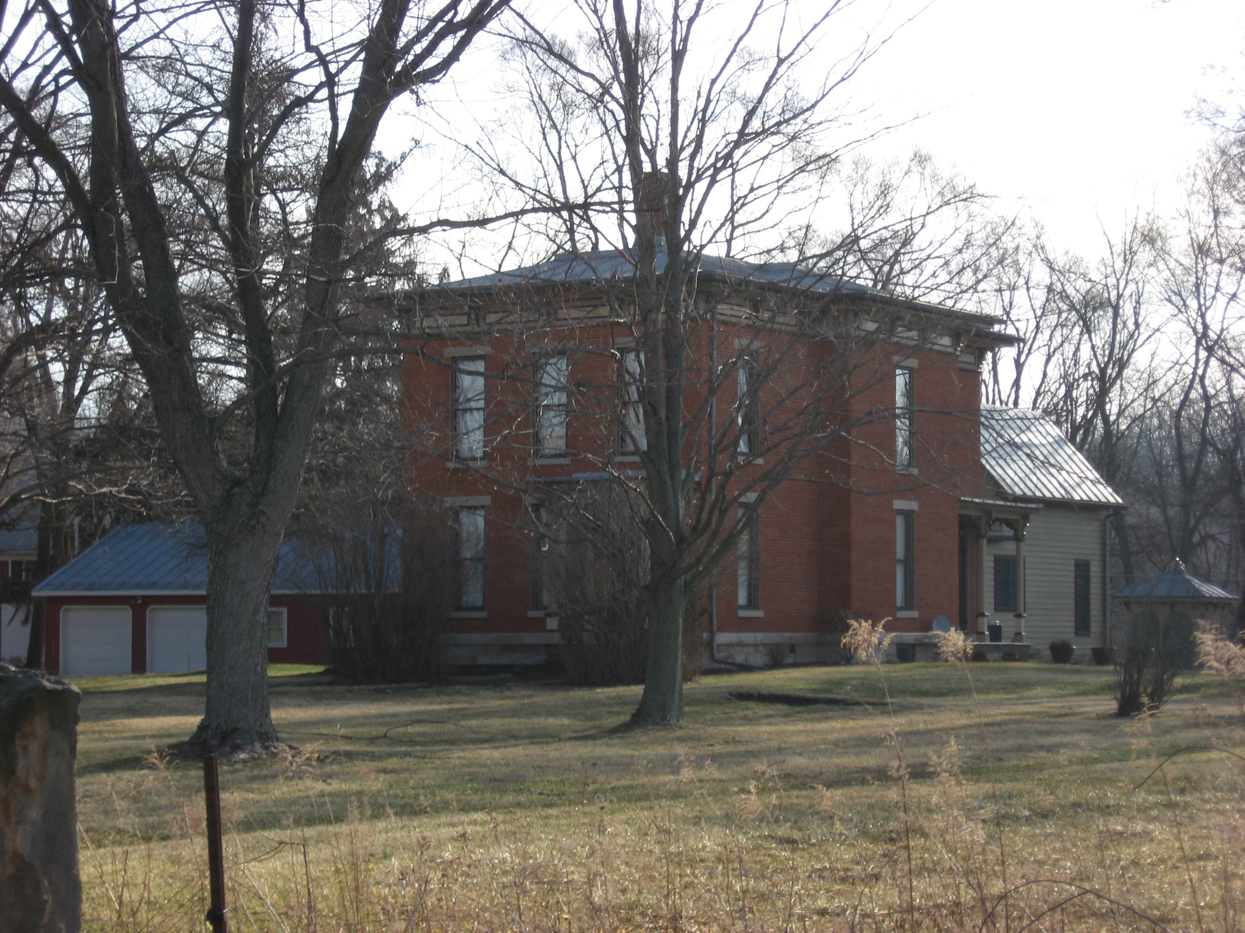
This is an image of a place or building that is listed on the National Register of Historic Places in the United States of America. Its reference number is 82003619. |
| Camera location | | View this and other nearby images on: OpenStreetMap |
|---|
| Description |
English: Front of the Samuel P. Brown House, located at 2405 County Road 24 south of Fulton in Lincoln Township, Morrow County, Ohio, United States. Built in 1880, it is listed on the National Register of Historic Places. |
||
| Date | Taken on 17 March 2011 | ||
| Source | Own work | ||
| Author | Nyttend | ||
| Permission (Reusing this file) |
|
||
| OpenStreetMap | Way 488651352 |
| Object location | | View this and other nearby images on: OpenStreetMap |
|---|
File history
Click on a date/time to view the file as it appeared at that time.
| Date/Time | Thumbnail | Dimensions | User | Comment | |
|---|---|---|---|---|---|
| current | 11:51, 19 March 2011 | | 2,816 × 2,112 (2.78 MB) | Nyttend (talk | contribs) | {{Location|40|26|31|N|82|50|48|W}} {{Information |Description={{en|Front of the {{w|Reuben Benedict House}}, located at 2405 County Road 24 south of {{w|Fulton, Ohio|Fulton}} in {{w|Lincoln Township, Morrow County, Ohio|Lincoln Township}}, {{w|Morrow Coun |
You cannot overwrite this file.
File usage on Commons
The following 2 pages use this file:
File usage on other wikis
The following other wikis use this file:
- Usage on en.wikipedia.org
- Usage on es.wikipedia.org
- Usage on eu.wikipedia.org
- Usage on fa.wikipedia.org
- Usage on pt.wikipedia.org
- Usage on ur.wikipedia.org
- Usage on vi.wikipedia.org
- Usage on www.wikidata.org
- Usage on zh.wikipedia.org