File:Samsun Kalesi sınırları, 1856.jpg
Jump to navigation
Jump to search

Size of this preview: 800 × 458 pixels. Other resolutions: 320 × 183 pixels | 640 × 367 pixels | 1,023 × 586 pixels.
Original file (1,023 × 586 pixels, file size: 227 KB, MIME type: image/jpeg)
Captions
Captions
Add a one-line explanation of what this file represents
Summary
[edit]
| Description |
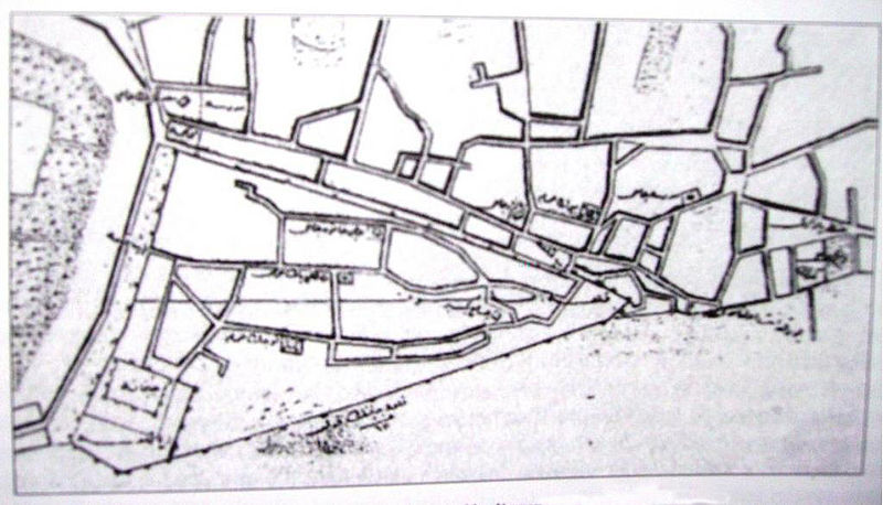
Türkçe: 1856 yılına ait Samsun haritasında kale sınırları. |
| Date | |
| Source | Samsun Yerel Tarih Grubu |
| Author | Dönemin şehir planlamacıları |
Licensing
[edit]
This work first published in the Ottoman Empire is now in the public domain because the Empire's copyright formalities were not met (copyright notice, registration, and deposit), or because the copyright term (30 years after the death of the author, sometimes less) expired before the Empire was dissolved (details).
|
.svg) |
File history
Click on a date/time to view the file as it appeared at that time.
| Date/Time | Thumbnail | Dimensions | User | Comment | |
|---|---|---|---|---|---|
| current | 06:34, 7 August 2013 | | 1,023 × 586 (227 KB) | 𐰇𐱅𐰚𐰤 (talk | contribs) | User created page with UploadWizard |
You cannot overwrite this file.
File usage on Commons
There are no pages that use this file.
File usage on other wikis
The following other wikis use this file:
- Usage on el.wikipedia.org
- Usage on en.wikipedia.org
- Usage on tr.wikipedia.org
- Usage on www.wikidata.org