File:Salzberg 1826.jpg
Jump to navigation
Jump to search
Size of this preview: 663 × 600 pixels. Other resolutions: 265 × 240 pixels | 531 × 480 pixels | 849 × 768 pixels | 1,132 × 1,024 pixels | 1,327 × 1,200 pixels.
Original file (1,327 × 1,200 pixels, file size: 1.29 MB, MIME type: image/jpeg)
Captions
Captions
Add a one-line explanation of what this file represents
Summary
[edit]
| Description |
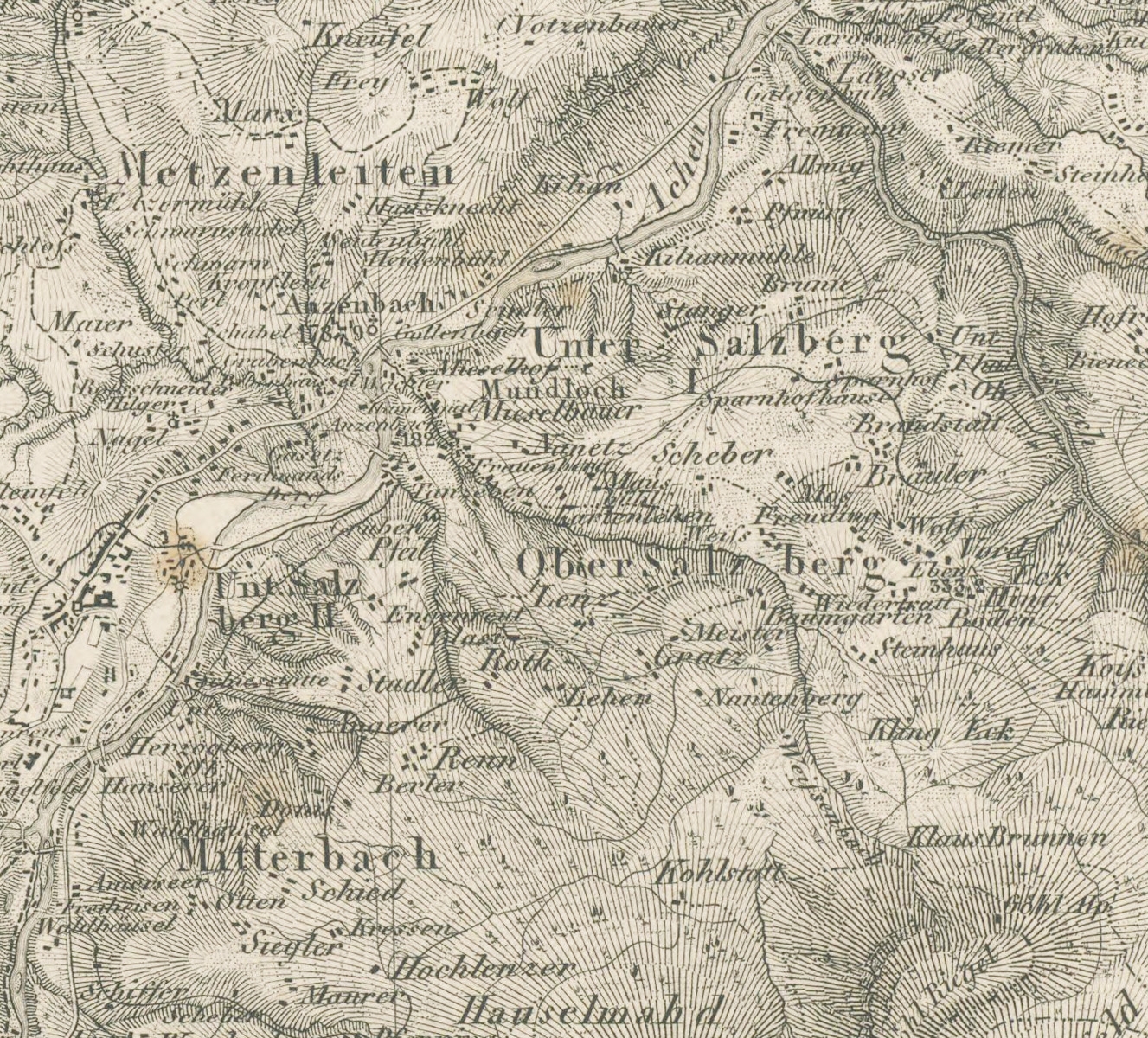
Deutsch: Das Gebiet der Gnotschaftsbezirke von Salzberg auf einer Karte von 1826 |
| Date | |
| Source | Bayerische Landesbibliothek |
| Author | Topographisches Bureau des Königl. Bayer. Generalstabes |
Licensing
[edit]
|
This work is in the public domain in its country of origin and other countries and areas where the copyright term is the author's life plus 70 years or fewer. | |
| This file has been identified as being free of known restrictions under copyright law, including all related and neighboring rights. | |
File history
Click on a date/time to view the file as it appeared at that time.
| Date/Time | Thumbnail | Dimensions | User | Comment | |
|---|---|---|---|---|---|
| current | 11:59, 7 October 2011 | | 1,327 × 1,200 (1.29 MB) | Geisler Martin (talk | contribs) | {{Information |Description ={{de|1=Das Gebiet der Gnotschaftsbezirke von Salzberg auf einer Karte von 1826}} |Source = [http://www.bayerische-landesbibliothek-online.de/histkarten/suche?kartenid=382 Bayerische Landesbibliothek] |Author |
You cannot overwrite this file.
File usage on Commons
There are no pages that use this file.
File usage on other wikis
The following other wikis use this file:
- Usage on de.wikipedia.org