File:Salt Lake (so called) - geograph.org.uk - 342669.jpg
Jump to navigation
Jump to search
No higher resolution available.
Salt_Lake_(so_called)_-_geograph.org.uk_-_342669.jpg (640 × 480 pixels, file size: 120 KB, MIME type: image/jpeg)
Captions
Captions
Add a one-line explanation of what this file represents
Summary
[edit]_-_geograph.org.uk_-_342669.jpg&action=edit§ion=1)
| Description |
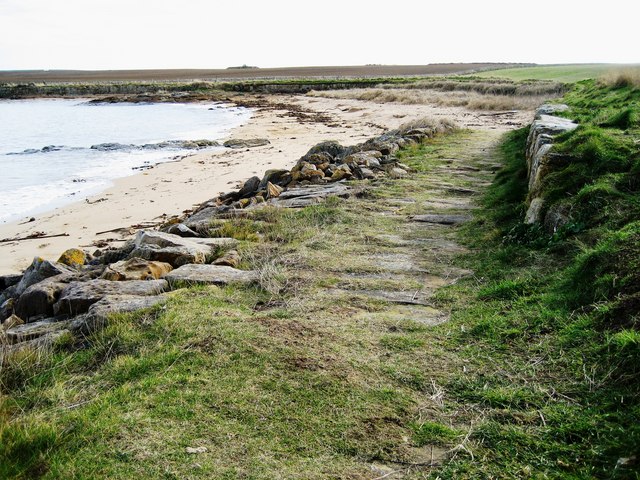
English: Salt Lake (so called) This location is called Salt Lake on the OS 1:25,000 scale map, although it appears nowadays to be fully tidal. There is a coastal protection stone faced dyke that runs for a few hundred metres around this bay. Perhaps prior to its construction there was a salt lake here. Does anyone know origin of the name?
This photograph is also part of what is unofficially known as Pitmilly Beach, although it is not marked as such on maps. |
| Date | |
| Source | From geograph.org.uk |
| Author | Robert Bone |
| Attribution (required by the license) | Robert Bone / Salt Lake (so called) / |
| Camera location | | View this and other nearby images on: OpenStreetMap |
|---|
_-_geograph.org.uk_-_342669.jpg¶ms=056.320030_N_-002.672800_E_globe:Earth_type:camera_source:geograph-osgb36(NO58481438)_heading:135.00&language=en)
| Object location | | View this and other nearby images on: OpenStreetMap |
|---|
_-_geograph.org.uk_-_342669.jpg¶ms=056.319590_N_-002.671800_E_globe:Earth_class:object_type:object_source:geograph-osgb36(NO58541433)_heading:135.00&language=en)
Licensing
[edit]_-_geograph.org.uk_-_342669.jpg&action=edit§ion=2)

|
This image was taken from the Geograph project collection. See this photograph's page on the Geograph website for the photographer's contact details. The copyright on this image is owned by Robert Bone and is licensed for reuse under the Creative Commons Attribution-ShareAlike 2.0 license.
|
This file is licensed under the Creative Commons Attribution-Share Alike 2.0 Generic license.
Attribution: Robert Bone
- You are free:
- to share – to copy, distribute and transmit the work
- to remix – to adapt the work
- Under the following conditions:
- attribution – You must give appropriate credit, provide a link to the license, and indicate if changes were made. You may do so in any reasonable manner, but not in any way that suggests the licensor endorses you or your use.
- share alike – If you remix, transform, or build upon the material, you must distribute your contributions under the same or compatible license as the original.
File history
Click on a date/time to view the file as it appeared at that time.
| Date/Time | Thumbnail | Dimensions | User | Comment | |
|---|---|---|---|---|---|
| current | 17:49, 2 January 2011 | | 640 × 480 (120 KB) | GeographBot (talk | contribs) | == {{int:filedesc}} == {{Information |description={{en|1=Salt Lake (so called) This location is called Salt Lake on the OS 1:25,000 scale map, although it appears nowadays to be fully tidal. There is a coastal protection stone faced dyke that runs for a |
You cannot overwrite this file.
File usage on Commons
There are no pages that use this file.
_-_geograph.org.uk_-_342669.jpg&oldid=716367841)