File:Salinengebiet Jagstfeld OSM.jpg
Jump to navigation
Jump to search

Size of this preview: 800 × 567 pixels. Other resolutions: 320 × 227 pixels | 640 × 454 pixels | 1,024 × 726 pixels | 1,280 × 908 pixels | 1,482 × 1,051 pixels.
Original file (1,482 × 1,051 pixels, file size: 311 KB, MIME type: image/jpeg)
Captions
Captions
Add a one-line explanation of what this file represents
Summary
[edit]
| Description |
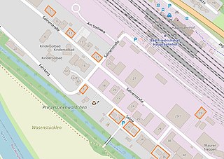
Das Salinengebiet in Jagstfeld: die acht erhalten gebliebenen Gebäude aus der Salinenzeit gekennzeichnet. This map of
|
|||||||||
| Date | 2021a | |||||||||
| Source | openstreetmap.org | |||||||||
| Creator |
openstreetmap.de (hat offensichtlich Probleme mit dem Wort "Prinzessinnen") OpenStreetMap contributors |
|||||||||
| Permission (Reusing this file) |
OpenStreetMap data is available under the Open Database License (details). Standard style map tiles are licensed as ODbL Produced Works.
|
|||||||||
| Geotemporal data | ||||||||||
| Bounding box |
|
|||||||||
File history
Click on a date/time to view the file as it appeared at that time.
| Date/Time | Thumbnail | Dimensions | User | Comment | |
|---|---|---|---|---|---|
| current | 15:25, 20 April 2021 | | 1,482 × 1,051 (311 KB) | Sarang (talk | contribs) | number of building Saline 5 |
| 11:08, 19 April 2021 |  | 1,482 × 1,064 (376 KB) | Sarang (talk | contribs) | {{openstreetmap |location={{Object location|49|13|48|N|09|11|56|E|dim:2000}} |description=Das Salinengebiet in {{Wd|Jagstfeld}}: die erhalten gebliebenen Gebäude aus der Salinenzeit {{#tag:span|gekennzeichnet|style=border:2px solid #F40}}.<br><br> |date=2021a |authors=openstreetmap.de |warp_status=skip |top =49.2322345 |bottom=49.2285073 |left =09.1941994 |right =09.2020181 }} <!-- Category:Jagstfeld --> Category:Maps of Bad Friedrichshall [[Category:Salinengebiet Jagstfe... |
You cannot overwrite this file.
File usage on Commons
The following 2 pages use this file: