File:Sakurajima Landsat image.jpg
Jump to navigation
Jump to search

Size of this preview: 637 × 600 pixels. Other resolutions: 255 × 240 pixels | 510 × 480 pixels.
Original file (800 × 753 pixels, file size: 86 KB, MIME type: image/jpeg)
Captions
Captions
Add a one-line explanation of what this file represents
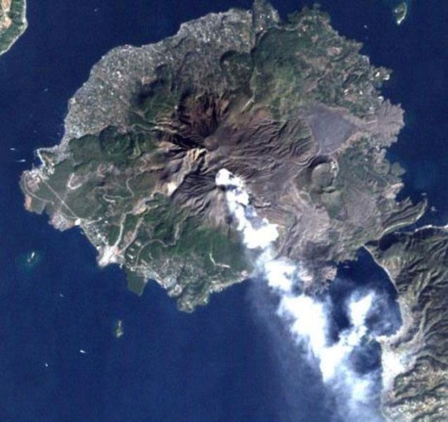
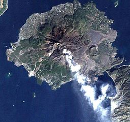
Sakurajima volcano, Japan, imaged by Landsat satellite.
From [1].
| This file is in the public domain in the United States because it was solely created by NASA. NASA copyright policy states that "NASA material is not protected by copyright unless noted". (See Template:PD-USGov, NASA copyright policy page or JPL Image Use Policy.) | ||
 |
Warnings:
|
File history
Click on a date/time to view the file as it appeared at that time.
| Date/Time | Thumbnail | Dimensions | User | Comment | |
|---|---|---|---|---|---|
| current | 12:12, 16 October 2006 | | 800 × 753 (86 KB) | Pazuzu (talk | contribs) | Sakurajima volcano, Japan, imaged by Landsat satellite. From [http://landsat.usgs.gov/gallery/]. {{PD-USGov-NASA}} Category:Sakurajima |
You cannot overwrite this file.
File usage on Commons
The following page uses this file:
File usage on other wikis
The following other wikis use this file:
- Usage on azb.wikipedia.org
- Usage on bg.wikipedia.org
- Usage on de.wikipedia.org
- Usage on en.wikipedia.org
- Usage on es.wikipedia.org
- Usage on fi.wikipedia.org
- Usage on fr.wikinews.org
- Usage on he.wikipedia.org
- Usage on id.wikipedia.org
- Usage on it.wikipedia.org
- Usage on ja.wikipedia.org
View more global usage of this file.