File:Saitama-ken géolocalisation relief.svg
Jump to navigation
Jump to search

Size of this PNG preview of this SVG file: 800 × 512 pixels. Other resolutions: 320 × 205 pixels | 640 × 410 pixels | 1,024 × 656 pixels | 1,280 × 819 pixels | 2,560 × 1,639 pixels | 1,715 × 1,098 pixels.
Original file (SVG file, nominally 1,715 × 1,098 pixels, file size: 1.84 MB)
Captions
Captions
Add a one-line explanation of what this file represents
Summary
[edit]
| Camera location | | View this and other nearby images on: OpenStreetMap |
|---|
| Description |
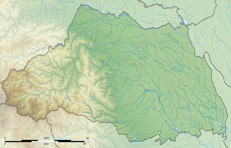
Français : Carte topographique vierge de la Préfecture de Saitama, au Japon, destinée à la géolocalisation.
Deutsch: Topographische Karte der Präfektur Saitama.
English: Topographic blank map of theSaitama Prefecture, for geolocalisation purpose.
Español: Mapa topográfico de la Prefectura de Saitama.
Italiano: Mappa topografica della Prefettura di Saitama.
日本語: 埼玉県の地図.
Português: Carta topográfica de la província de Saitama.
|
||
| Date | (UTC) | ||
| Source |
Création personnelle ;
|
||
| Author | © Bourrichon (talk) - fr:Bourrichon | ||
| Permission (Reusing this file) |
|
||
| Other versions | File:Saitama-ken géolocalisation.svg |

|
This SVG file contains embedded text that can be translated into your language, using any capable SVG editor, text editor or the SVG Translate tool. For more information see: About translating SVG files. |
This W3C-unspecified vector image was created with Inkscape .
Licensing
[edit]
I, the copyright holder of this work, hereby publish it under the following license:
This file is licensed under the Creative Commons Attribution-Share Alike 2.0 France license.
Attribution: Bourrichon (atelier graphique)
- You are free:
- to share – to copy, distribute and transmit the work
- to remix – to adapt the work
- Under the following conditions:
- attribution – You must give appropriate credit, provide a link to the license, and indicate if changes were made. You may do so in any reasonable manner, but not in any way that suggests the licensor endorses you or your use.
- share alike – If you remix, transform, or build upon the material, you must distribute your contributions under the same or compatible license as the original.

File history
Click on a date/time to view the file as it appeared at that time.
| Date/Time | Thumbnail | Dimensions | User | Comment | |
|---|---|---|---|---|---|
| current | 18:49, 3 July 2013 | | 1,715 × 1,098 (1.84 MB) | Bourrichon (talk | contribs) | == {{int:filedesc}} == {{Location|36|50|00|N|139|00|00|E|scale:10000}} {{Information |Description= {{fr|Carte topographique vierge de la préfecture métropolitaine de Tokyo (東京都, ''Tōkyō-to''), au [[:fr:Japon|Japon... |
You cannot overwrite this file.
File usage on Commons
The following 28 pages use this file:
- Saitama prefecture
- Category:Births in Saitama prefecture
- Category:Castles in Saitama prefecture
- Category:Companies based in Saitama prefecture
- Category:Concert halls in Saitama prefecture
- Category:Dams in Saitama prefecture
- Category:Deaths in Saitama prefecture
- Category:Defunct companies based in Saitama prefecture
- Category:Education in Saitama prefecture
- Category:Factories in Saitama prefecture
- Category:Hospitals in Saitama prefecture
- Category:Maps of Saitama prefecture
- Category:Michinoeki in Saitama prefecture
- Category:Mountains of Saitama prefecture
- Category:Organizations in Saitama prefecture
- Category:People of Saitama prefecture
- Category:Power plants in Saitama prefecture
- Category:Rail transport in Saitama prefecture
- Category:Roads in Saitama prefecture
- Category:Saitama prefecture
- Category:Sports in Saitama prefecture
- Category:Sports teams in Saitama prefecture
- Category:Towns in Saitama prefecture
- Category:Train stations in Saitama prefecture
- Category:Transport in Saitama prefecture
- Category:Views of Saitama prefecture
- Category:Villages in Saitama prefecture
- Category:Visitor attractions in Saitama prefecture
File usage on other wikis
The following other wikis use this file:
- Usage on ar.wikipedia.org
- Usage on ceb.wikipedia.org
- Usage on ce.wikipedia.org
- Usage on de.wikipedia.org
- Usage on en.wikipedia.org
- Saitama Prefecture
- Hikawa Shrine (Saitama)
- Siege of Musashi-Matsuyama (1563)
- Kawagoe Castle
- Kumagaya Athletic Stadium
- Hachigata Castle
- Inariyama Kofun
- Minuma Tsūsen-bori
- Taki-no Castle
- Module:Location map/data/Japan Saitama Prefecture/doc
- Oshi Castle
- Iwatsuki Castle
- Handa Cup Senior Masters
- 1957 Canada Cup
- Koma Shrine
- Module:Location map/data/Japan Saitama Prefecture
- User:Ty654/List of earthquakes from 1920-1929 exceeding magnitude 6+
- User:Ty654/List of earthquakes from 1930-1939 exceeding magnitude 6+
- User:Ty654/List of earthquakes from 1965-1969 exceeding magnitude 6+
- Sugaya Yakata
- Sugiyama Castle
- Omishinkanji Kofun
- Miyazuka Kofun
- Mizuko Shell Mound
- Kurohama shell mound
- Shinpukuji shell mound
- Kawagoekan
- Gobōyama Site
- Tochimoto Barrier
- Nogamishimogō Stele
- Shinmei Shell Mound
- Minamikawara Stele
- Komae Village Stone Age Dwelling Site
- Shimozato-Aoyama Stele Production Site
- Suedono Tile Kiln
- Ōya Tile Kiln
- Hara kanga ruins
- Matsuyama Castle (Ranzan)
- Maruhakayama Kofun
- Teppōyama Kofun
- Kawarazuka Kofun
View more global usage of this file.