File:Saint-Barthélemy collectivity location map with quartiers.svg
Jump to navigation
Jump to search

Size of this PNG preview of this SVG file: 800 × 526 pixels. Other resolutions: 320 × 210 pixels | 640 × 420 pixels | 1,024 × 673 pixels | 1,280 × 841 pixels | 2,560 × 1,682 pixels | 1,175 × 772 pixels.
Original file (SVG file, nominally 1,175 × 772 pixels, file size: 135 KB)
Captions
Captions
Add a one-line explanation of what this file represents
Summary
[edit]| Camera location | | View this and other nearby images on: OpenStreetMap |
|---|
| Description |
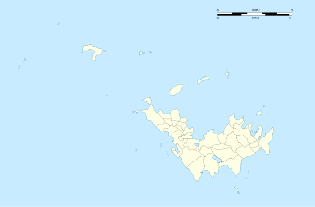
English: Blank administrative map of the overseas collectivity of Saint Barthélemy, France, with Quartiers boundaries, for geo-location purpose.
Français : Carte administrative vierge de la collectivité d'outre-mer de Saint-Barthélemy, France, avec limites des quartiers, destinée à la géolocalisation. Estimated scales: 1:200,000 (precision: 50 m)
Geographic limits of the map:
|
||
| Date | |||
| Source |
Own work
|
||
| Author | Eric Gaba (Sting - fr:Sting) | ||
| Permission (Reusing this file) |
|
||
| Other versions |
|


Licensing
[edit]
Eric Gaba, Wikimedia Commons user Sting, the copyright holder of this work, hereby publishes it under the following licenses:
This file is licensed under the Creative Commons Attribution-Share Alike 3.0 Unported license.
Attribution: Eric Gaba, Wikimedia Commons user Sting
- You are free:
- to share – to copy, distribute and transmit the work
- to remix – to adapt the work
- Under the following conditions:
- attribution – You must give appropriate credit, provide a link to the license, and indicate if changes were made. You may do so in any reasonable manner, but not in any way that suggests the licensor endorses you or your use.
- share alike – If you remix, transform, or build upon the material, you must distribute your contributions under the same or compatible license as the original.

|
Permission is granted to copy, distribute and/or modify this document under the terms of the GNU Free Documentation License, Version 1.2 or any later version published by the Free Software Foundation; with no Invariant Sections, no Front-Cover Texts, and no Back-Cover Texts. A copy of the license is included in the section entitled GNU Free Documentation License. |
You may select the license of your choice.
File history
Click on a date/time to view the file as it appeared at that time.
| Date/Time | Thumbnail | Dimensions | User | Comment | |
|---|---|---|---|---|---|
| current | 02:01, 26 February 2010 | | 1,175 × 772 (135 KB) | Sting (talk | contribs) | == {{int:filedesc}} == {{Location|17|55|30|N|62|51|45|W|scale:50000}} <br/> {{Information |Description={{en|Blank administrative map of the overseas collectivity of Saint Barthélemy, [[:en:France|Fr |
You cannot overwrite this file.
File usage on Commons
The following 3 pages use this file:
File usage on other wikis
The following other wikis use this file:
- Usage on ar.wikipedia.org
- Usage on ast.wikipedia.org
- Usage on bg.wikipedia.org
- Usage on bn.wikipedia.org
- Usage on bs.wikipedia.org
- Usage on ceb.wikipedia.org
- Plantilya:Location map Saint Barthélemy
- West Channel
- South Channel
- Goat Island
- Sugarloaf
- Southeast Channel
- Canal du Sud
- Baie de Saint-Jean
- Saint Barthelemy
- Saint Bartholomew Island
- Saint-Barthélemy (pagklaro)
- Roches Rouges
- Roques (pagklaro)
- Île de la Pointe
- Le Pain de Sucre
- Canal de l'Ouest
- Pointe Nègre
- Pointe Negre
- Pointe Lézarde
- Les Saintes
- Les Islettes (pagklaro)
- Les Baleines
- Le Carénage
- La Tortue
- Île Tortue
- La Baleine (pagklaro)
- Roche Baleine
- Gustaf
- Grande Pointe
- Île Frégate
- Ile Fregate
- Îlet Frégate
- Fourche
- Pointe Colombier
- Ile Coco
- Barrel of Beef
- Le Boeuf
- Baie des Flamands
- Morne du Vitet
- Pointe à Toigny
- Île Toc Vers
- Roche Table
View more global usage of this file.