File:Sagar 2018-05-19 1945Z.jpg
Jump to navigation
Jump to search
Size of this preview: 592 × 600 pixels. Other resolutions: 237 × 240 pixels | 474 × 480 pixels | 758 × 768 pixels | 1,041 × 1,055 pixels.
Original file (1,041 × 1,055 pixels, file size: 763 KB, MIME type: image/jpeg)
Captions
Captions
Add a one-line explanation of what this file represents
Summary
[edit]
| Description |
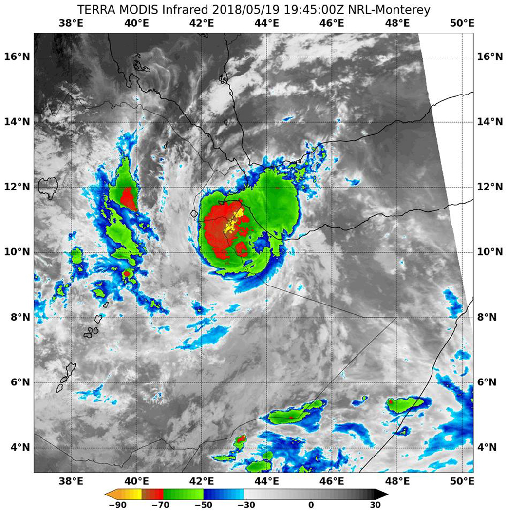
English: Tropical Cyclone Sagar Makes Landfall
The final bulletin on Sagar was issued at 11 a.m. EDT (1500 UTC) on May 19. By that time, Sagar had made landfall in Somalia. Its center was located over land, near 10.3 north latitude and 43.7 east longitude, about 88 miles south-southeast of Djibouti City, Djibouti. NASA's Terra satellite captured this infrared image of the storm at landfall. Sagar was moving to the southwest at 7 knots and maintained maximum sustained winds near 50 knots. Sagar will now weaken and dissipate overland. |
| Date | |
| Source | https://www.nasa.gov/feature/goddard/2018/sagar-indian-ocean |
| Author | NRL |
Licensing
[edit]
This file is a work of a sailor or employee of the U.S. Navy, taken or made as part of that person's official duties. As a work of the U.S. federal government, it is in the public domain in the United States.
|
 | |
| This file has been identified as being free of known restrictions under copyright law, including all related and neighboring rights. | ||
File history
Click on a date/time to view the file as it appeared at that time.
| Date/Time | Thumbnail | Dimensions | User | Comment | |
|---|---|---|---|---|---|
| current | 09:24, 29 May 2018 | | 1,041 × 1,055 (763 KB) | A1Cafel (talk | contribs) | original |
| 03:55, 21 May 2018 |  | 947 × 960 (163 KB) | A1Cafel (talk | contribs) | User created page with UploadWizard |
You cannot overwrite this file.
File usage on Commons
The following 2 pages use this file: