File:SabalanGlaciers.png
Jump to navigation
Jump to search
Size of this preview: 400 × 600 pixels. Other resolutions: 160 × 240 pixels | 320 × 480 pixels.
Original file (800 × 1,200 pixels, file size: 266 KB, MIME type: image/png)
Captions
Captions
Add a one-line explanation of what this file represents
Summary
[edit]
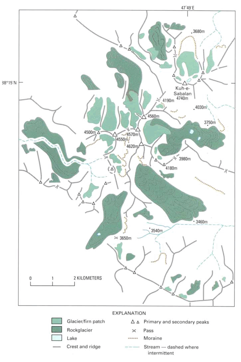
| Description | Map of summit region and glaciers on Sabalan, a stratovolcano in Iran. | |||
| Date | ||||
| Source | Williams, Richard S., Jr.; Ferrigno, Jane G. (eds.) (1991) Satellite Image Atlas of Glaciers of the World -- Middle East and Africa, USGS Professional Paper 1386-G, pp. p. 39 | |||
| Author | USGS | |||
| Permission (Reusing this file) |
|
|||
| Location | Iran |
File history
Click on a date/time to view the file as it appeared at that time.
| Date/Time | Thumbnail | Dimensions | User | Comment | |
|---|---|---|---|---|---|
| current | 04:22, 22 April 2007 | | 800 × 1,200 (266 KB) | Seattle Skier (talk | contribs) | == Summary == {{Information |Description= Map of summit region and glaciers on Sabalan, a stratovolcano in Iran. |Source= {{cite book | last = Williams | first = Richard S., Jr. | coauthors= Ferrigno, Jane G. (eds.) | title = Satellite Ima |
You cannot overwrite this file.
File usage on Commons
There are no pages that use this file.
File usage on other wikis
The following other wikis use this file: