File:Saarschleife panorama.jpg
Jump to navigation
Jump to search

Size of this preview: 800 × 405 pixels. Other resolutions: 320 × 162 pixels | 640 × 324 pixels | 1,024 × 519 pixels | 1,280 × 649 pixels | 2,560 × 1,297 pixels | 7,500 × 3,800 pixels.
Original file (7,500 × 3,800 pixels, file size: 22.74 MB, MIME type: image/jpeg)
Captions
Captions
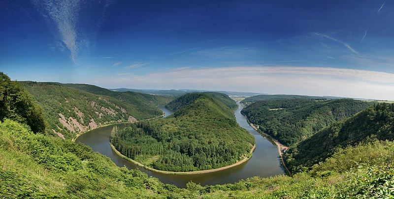
Panoramic View of Saarschleife and Montclair mountain seen from Cloef
Summary
[edit]
| Description | Saarschleife und Montclair Berg von der Cloef aus gesehen |
| Date | Taken on 16 June 2006 |
| Source | Own work |
| Author | Pascal Dihé |
| Attribution (required by the license) | © Pascal Dihé / https://www.dihe.eu / |
| Camera location | | View this and other nearby images on: OpenStreetMap |
|---|
Licensing
[edit]
Pascal Dihé, the copyright holder of this work, hereby publishes it under the following license:
This file is licensed under the Creative Commons Attribution-Share Alike 4.0 International license.
Attribution: Pascal Dihé / www.dihe.eu / CC BY-SA 4.0
- You are free:
- to share – to copy, distribute and transmit the work
- to remix – to adapt the work
- Under the following conditions:
- attribution – You must give appropriate credit, provide a link to the license, and indicate if changes were made. You may do so in any reasonable manner, but not in any way that suggests the licensor endorses you or your use.
- share alike – If you remix, transform, or build upon the material, you must distribute your contributions under the same or compatible license as the original.
File history
Click on a date/time to view the file as it appeared at that time.
| Date/Time | Thumbnail | Dimensions | User | Comment | |
|---|---|---|---|---|---|
| current | 20:02, 22 February 2019 | | 7,500 × 3,800 (22.74 MB) | Pascal Dihé (talk | contribs) | replacement with higher resolution version of the same file |
| 13:56, 18 June 2006 |  | 2,625 × 1,330 (2.41 MB) | DrAlzheimer (talk | contribs) | {{Information| |Description=Saarschleife und Montclair Berg von der Cloef aus gesehen |Source=selbst aufgenommen |Date=2006-06-16 |Author=DrAlzheimer) |Permission= GFDL und Creative Commons CC-BY 2.5 |other_versions = - }} }} |
You cannot overwrite this file.
File usage on Commons
The following page uses this file:
File usage on other wikis
The following other wikis use this file:
- Usage on de.wikipedia.org
- Usage on en.wikipedia.org