File:SZ-lubombo.png
Jump to navigation
Jump to search
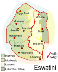
Size of this preview: 485 × 599 pixels. Other resolutions: 194 × 240 pixels | 389 × 480 pixels | 643 × 794 pixels.
Original file (643 × 794 pixels, file size: 1.46 MB, MIME type: image/png)
Captions
Captions
Add a one-line explanation of what this file represents
Summary
[edit]
| Description |
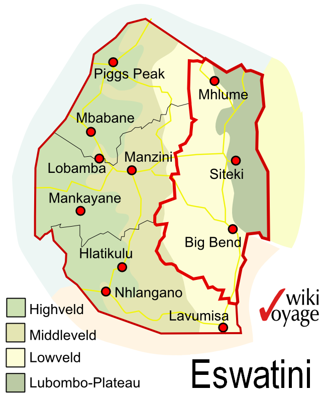
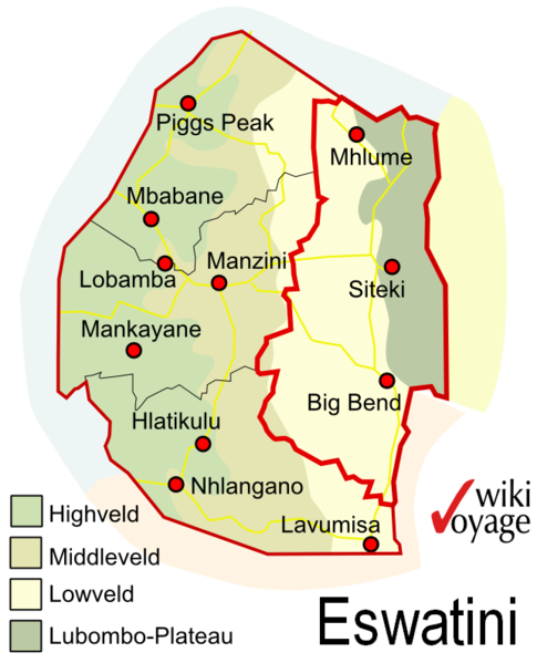
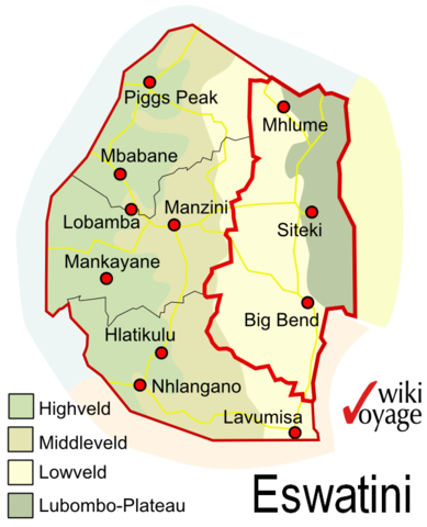
Deutsch: Umrisskarte Distrikt Lubombo in Eswatini English: Outline map of District Lubombo in Eswatini |
| Date | |
| Source | Own work |
| Author | Bgabel |
Licensing
[edit]
User: Bgabel at wikivoyage shared, the copyright holder of this work, hereby publishes it under the following licenses:

|
Permission is granted to copy, distribute and/or modify this document under the terms of the GNU Free Documentation License, Version 1.2 or any later version published by the Free Software Foundation; with no Invariant Sections, no Front-Cover Texts, and no Back-Cover Texts. A copy of the license is included in the section entitled GNU Free Documentation License. |
This file is licensed under the Creative Commons Attribution-Share Alike 3.0 Unported, 2.5 Generic, 2.0 Generic and 1.0 Generic license.
Attribution: User: Bgabel at wikivoyage shared
- You are free:
- to share – to copy, distribute and transmit the work
- to remix – to adapt the work
- Under the following conditions:
- attribution – You must give appropriate credit, provide a link to the license, and indicate if changes were made. You may do so in any reasonable manner, but not in any way that suggests the licensor endorses you or your use.
- share alike – If you remix, transform, or build upon the material, you must distribute your contributions under the same or compatible license as the original.
You may select the license of your choice.
Original upload log
[edit]
| This file was imported from Wikivoyage Shared. |
The original description page was here. All following user names refer to wikivoyage-old/shared.
- 2011-06-22 08:45 Bgabel archive copy at the Wayback Machine 643×794 (151857 bytes) {{Information |Description={{de|Distrikt Lubombo in Eswatini}} |Author=[[User:Bgabel|Bgabel]] |Date=22.06.2011 |Source={{own}} |Permission= |other_versions= }} [[Category:Manzini (district)]] [[Category:Maps (Eswatini)]]
File history
Click on a date/time to view the file as it appeared at that time.
| Date/Time | Thumbnail | Dimensions | User | Comment | |
|---|---|---|---|---|---|
| current | 05:49, 2 July 2020 | | 643 × 794 (1.46 MB) | Bestoernesto (talk | contribs) | Update country name [UN M49 Standard (https://unstats.un.org/unsd/methodology/m49/) / ISO 3166 (https://www.iso.org/obp/ui/#iso:code:3166:SZ) / "The Government of the Kingdom of Eswatini" (http://www.gov.sz/)] |
| 13:07, 2 December 2012 |  | 643 × 794 (148 KB) | MGA73bot2 (talk | contribs) | {{BotMoveToCommons|shared.oldwikivoyage|year={{subst:CURRENTYEAR}}|month={{subst:CURRENTMONTHNAME}}|day={{subst:CURRENTDAY}}}} == {{int:filedesc}} == {{Information |description={{de|Distrikt Lubombo in Swaziland}} |date=22.06.2011 |source={{own}}<BR />... |
You cannot overwrite this file.
File usage on Commons
There are no pages that use this file.