File:SVG-Koort Zentralafrikaansche Republik.svg
Jump to navigation
Jump to search

Size of this PNG preview of this SVG file: 800 × 475 pixels. Other resolutions: 320 × 190 pixels | 640 × 380 pixels | 1,024 × 608 pixels | 1,280 × 760 pixels | 2,560 × 1,520 pixels.
Original file (SVG file, nominally 800 × 475 pixels, file size: 84 KB)
Captions
Captions
Add a one-line explanation of what this file represents
| Description |
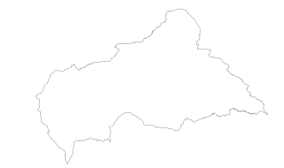
English: Outline of the Central African Republic. SVG source contains geographical data in coordinates.
Deutsch: Außengrenzen von Zentralafrikanische Republik. Im SVG-Quelltext sind die geographischen Daten in Form von Koordinaten zu finden.
Plattdüütsch: Butengrenzen vun Zentralafrikaansche Republik. In’n SVG-Borntext staht de geograafschen Daten as Koordinaten. |
||
| Source | Geographical data from Uganda Bureau of Statistics | ||
| Author | Slomox | ||
| Permission (Reusing this file) |
|
||
| SVG development |
File history
Click on a date/time to view the file as it appeared at that time.
| Date/Time | Thumbnail | Dimensions | User | Comment | |
|---|---|---|---|---|---|
| current | 20:54, 13 March 2008 | | 800 × 475 (84 KB) | Slomox (talk | contribs) | {{SVG-Map Africa by Slomox|en=Central African Republic|de=Zentralafrikanische Republik|nds=Zentralafrikaansche Republik}} |
You cannot overwrite this file.
File usage on Commons
There are no pages that use this file.