File:STS039-601-049 Jet Stream (cropped).jpg
Jump to navigation
Jump to search

Size of this preview: 800 × 599 pixels. Other resolutions: 320 × 240 pixels | 640 × 480 pixels | 1,024 × 767 pixels | 1,280 × 959 pixels | 2,560 × 1,918 pixels | 5,095 × 3,818 pixels.
Original file (5,095 × 3,818 pixels, file size: 3.92 MB, MIME type: image/jpeg)
Captions
Captions
Add a one-line explanation of what this file represents
| Description |
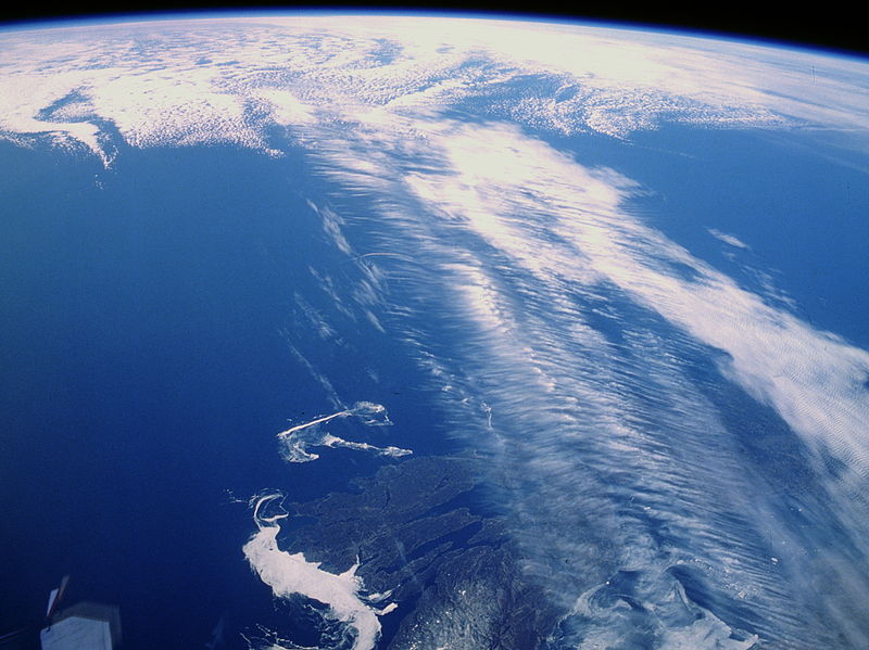
English: The Northern Hemisphere Jet Stream can be seen crossing Cape Breton Island in the Maritime Provinces of Eastern Canada. The Jet Stream is a narrow zone of high-speed winds typically found at altitudes of 4 to 8 miles (8-12 km) above the earth. They result from temperature contrasts between polar and tropical regions. The strongest Jet Stream winds are found in the winter when the contrast between polar and tropical regions is the greatest. Wind speeds can reach 90 to over 180 miles per hour (145 to over 290 km/h) from west to east. Jet Streams are found between latitudes 20° to near 55° north and south. During the winter months over the United States and southern Canada, the path taken by the Jet Stream can have a large influence on the weather conditions of this region. |
|||||
| Date | ||||||
| Source | https://www.flickr.com/photos/nasa2explore/9357272501/ | |||||
| Author | NASA | |||||
| Permission (Reusing this file) |
|


File history
Click on a date/time to view the file as it appeared at that time.
| Date/Time | Thumbnail | Dimensions | User | Comment | |
|---|---|---|---|---|---|
| current | 07:22, 6 May 2015 | | 5,095 × 3,818 (3.92 MB) | Jcpag2012 (talk | contribs) | Cropped version of File:STS039-601-049 Jet Stream.jpg using CropTool. |
You cannot overwrite this file.
File usage on Commons
The following page uses this file:
File usage on other wikis
The following other wikis use this file:
- Usage on es.wikipedia.org
- Usage on it.wikipedia.org
.jpg&oldid=910819502)