File:SNR Global 2018-12.png
Jump to navigation
Jump to search
Size of this preview: 800 × 431 pixels. Other resolutions: 320 × 173 pixels | 640 × 345 pixels | 1,024 × 552 pixels | 1,280 × 690 pixels | 2,560 × 1,380 pixels.
Original file (2,560 × 1,380 pixels, file size: 813 KB, MIME type: image/png)
Captions
Captions
Add a one-line explanation of what this file represents
Summary
[edit]
| Description |
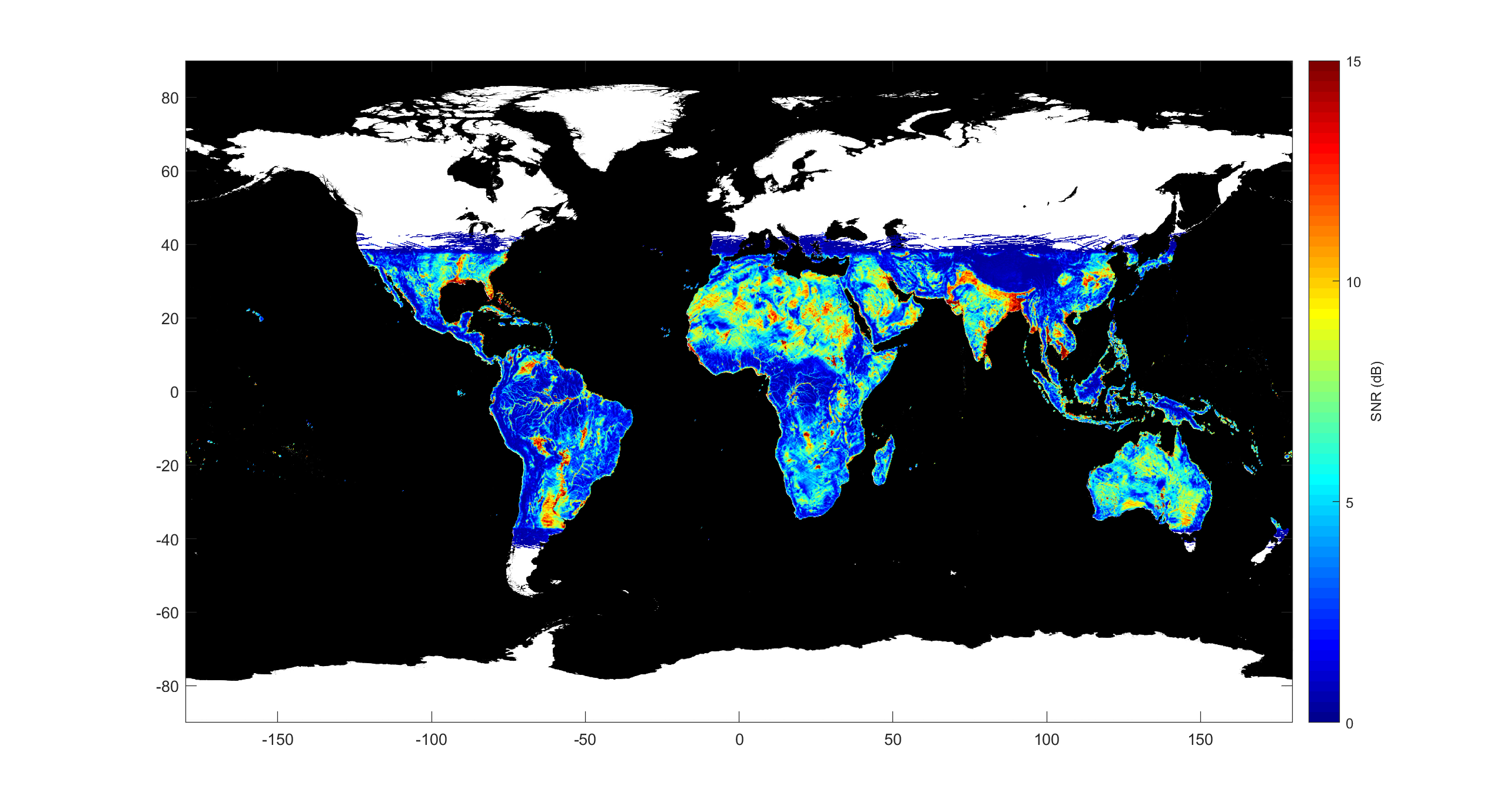
English: CYGNSS measurements of land surface scattering for the month of December 2017. Changes in soil moisture and the extent of inland waterways affect the measurements. |
| Date | |
| Source | Own work |
| Author | Cruf13386 |
Licensing
[edit]
I, the copyright holder of this work, hereby publish it under the following license:
This file is licensed under the Creative Commons Attribution-Share Alike 4.0 International license.
- You are free:
- to share – to copy, distribute and transmit the work
- to remix – to adapt the work
- Under the following conditions:
- attribution – You must give appropriate credit, provide a link to the license, and indicate if changes were made. You may do so in any reasonable manner, but not in any way that suggests the licensor endorses you or your use.
- share alike – If you remix, transform, or build upon the material, you must distribute your contributions under the same or compatible license as the original.
File history
Click on a date/time to view the file as it appeared at that time.
| Date/Time | Thumbnail | Dimensions | User | Comment | |
|---|---|---|---|---|---|
| current | 18:48, 21 January 2019 | | 2,560 × 1,380 (813 KB) | Cruf13386 (talk | contribs) | Cross-wiki upload from en.wikipedia.org |
You cannot overwrite this file.
File usage on Commons
There are no pages that use this file.
File usage on other wikis
The following other wikis use this file:
- Usage on en.wikipedia.org