File:S-200 site FRAG-511 Eckolstädt.png
Jump to navigation
Jump to search

Size of this preview: 600 × 600 pixels. Other resolutions: 240 × 240 pixels | 480 × 480 pixels | 768 × 768 pixels | 1,024 × 1,024 pixels | 2,048 × 2,048 pixels | 8,800 × 8,800 pixels.
Original file (8,800 × 8,800 pixels, file size: 50.06 MB, MIME type: image/png)
Captions
Captions
Add a one-line explanation of what this file represents
Summary
[edit]
| Warning | The original file is very high-resolution. It might not load properly or could cause your browser to freeze when opened at full size. |
|---|
| Description |
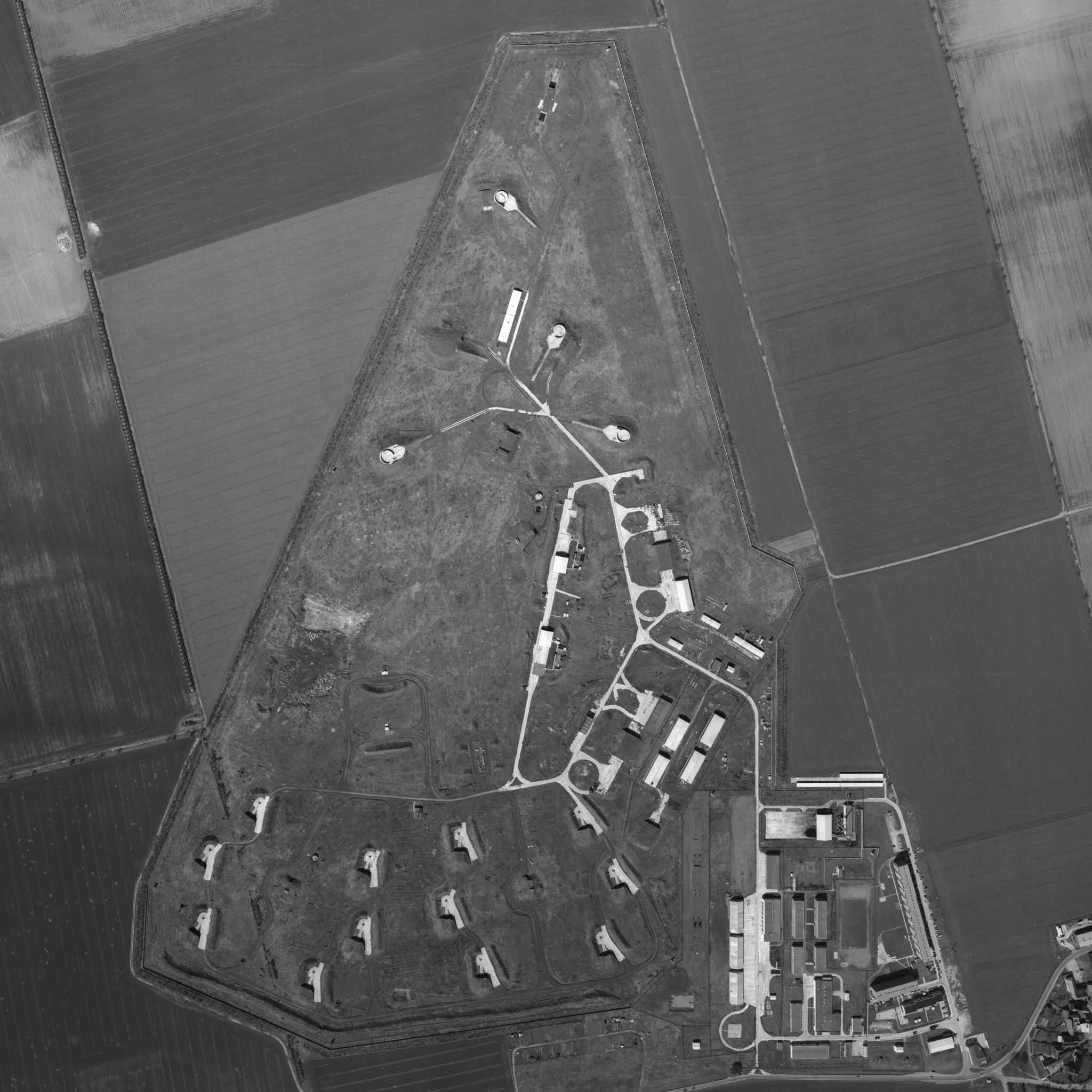
English: Former S-200 (SA-5) site of the NVA's Fla-Raketenabteilungsgruppe 511 (FRAG-511) near Eckolstädt, Thüringen. The site was never used due to German reunification preempting full delivery of its equipment. |
| Date | |
| Source | Offene Geodaten Thüringen, Historisches Luftbild 199502 0196 |
| Author | GDI-Th |
| Object location | | View this and other nearby images on: OpenStreetMap |
|---|
Licensing
[edit]

|
This file is licensed under the terms of the Data licence Germany – attribution – version 2.0 |
|
You are free:
Under the following conditions:
|
File history
Click on a date/time to view the file as it appeared at that time.
| Date/Time | Thumbnail | Dimensions | User | Comment | |
|---|---|---|---|---|---|
| current | 01:00, 27 July 2024 | | 8,800 × 8,800 (50.06 MB) | SteinsplitterBot (talk | contribs) | Bot: Image rotated by 180° |
| 17:35, 1 August 2023 |  | 8,800 × 8,800 (50.05 MB) | Recoil16 (talk | contribs) | Uploaded a work by GDI-Th, dl-de/by-2-0 from [https://www.geoportal-th.de/de-de/Downloadbereiche/Download-Offene-Geodaten-Th%C3%BCringen Offene Geodaten Thüringen, Historisches Luftbild 199502 0196] with UploadWizard |
You cannot overwrite this file.
File usage on Commons
There are no pages that use this file.