File:Rząśnik (gmina) location map.png
Jump to navigation
Jump to search

Size of this preview: 507 × 599 pixels. Other resolutions: 203 × 240 pixels | 406 × 480 pixels | 855 × 1,010 pixels.
Original file (855 × 1,010 pixels, file size: 113 KB, MIME type: image/png)
Captions
Captions
Add a one-line explanation of what this file represents
| Description |
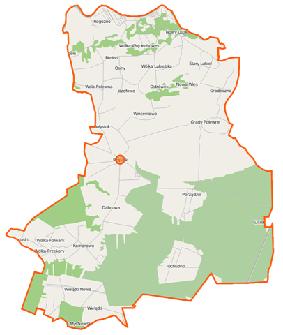
Polski: Mapa gminy Rząśnik, Polska
English: Map of Gmina Rząśnik, Poland |
|||||||||
| Date | ||||||||||
| Source | You may find a page on the OpenStreetMap wiki page for Rząśnik (gmina) | |||||||||
| Creator |
OpenStreetMap contributors OpenStreetMap contributors |
|||||||||
| Permission (Reusing this file) |
OpenStreetMap data is available under the Open Database License (details). Map tiles are licensed under the Creative Commons Attribution-ShareAlike 2.0 license (CC-BY-SA 2.0).
This file is licensed under the Creative Commons Attribution-Share Alike 2.0 Generic license.
|
|||||||||
| Geotemporal data | ||||||||||
| Bounding box |
|
|||||||||
| Georeferencing | If inappropriate please set warp_status = skip to hide. | |||||||||
File history
Click on a date/time to view the file as it appeared at that time.
| Date/Time | Thumbnail | Dimensions | User | Comment | |
|---|---|---|---|---|---|
| current | 05:50, 15 October 2014 | | 855 × 1,010 (113 KB) | VanWiel (talk | contribs) | {{OpenStreetMap | name = Rząśnik (gmina) | location = Rząśnik (gmina) | description = {{pl|Mapa gminy Rząśnik, Polska}} {{en|Map of Gmina Rząśnik, Poland}} | top = 52.7932 | left = 21.2678... |
You cannot overwrite this file.
File usage on Commons
There are no pages that use this file.
File usage on other wikis
The following other wikis use this file:
- Usage on fr.wikipedia.org
- Usage on pl.wikipedia.org
- Rząśnik (gmina)
- Gołystok
- Grądy Polewne
- Nowe Wielątki
- Nowy Lubiel
- Nury (województwo mazowieckie)
- Ochudno
- Plewica
- Porządzie
- Stary Lubiel
- Wielątki
- Wielątki-Folwark
- Wola Polewna
- Wólka Lubielska
- Wólka-Przekory
- Wólka-Wojciechówek
- Grodziczno (województwo mazowieckie)
- Rogóźno (województwo mazowieckie)
- Wólka-Folwark (województwo mazowieckie)
- Bielino (powiat wyszkowski)
- Dąbrowa (powiat wyszkowski)
- Janowo (powiat wyszkowski)
- Józefowo (powiat wyszkowski)
- Komorowo (powiat wyszkowski)
- Osiny (gmina Rząśnik)
- Ostrówek (powiat wyszkowski)
- Rząśnik (powiat wyszkowski)
- Wincentowo (powiat wyszkowski)
- Nowa Wieś (gmina Rząśnik)
- Parafia Najświętszej Maryi Panny Matki Kościoła w Rząśniku
- Gajówka Podwielątki
- Leśniczówka Dąbrowa
- Trzecie Pole-Gajówka
- Kościół św. Anny w Nowym Lubielu
- Moduł:Mapa/dane/Rząśnik (gmina)
- Parafia św. Stanisława Biskupa i Męczennika w Lubielu
- Parafia św. Teresy od Dzieciątka Jezus w Porządziu
- Usage on pl.wikibooks.org
_location_map.png&oldid=467421237)