File:RyfFok.jpg
Jump to navigation
Jump to search

Size of this preview: 800 × 600 pixels. Other resolutions: 320 × 240 pixels | 640 × 480 pixels | 1,024 × 768 pixels | 1,280 × 960 pixels | 1,600 × 1,200 pixels.
Original file (1,600 × 1,200 pixels, file size: 534 KB, MIME type: image/jpeg)
Captions
Captions
Add a one-line explanation of what this file represents
Summary
[edit]
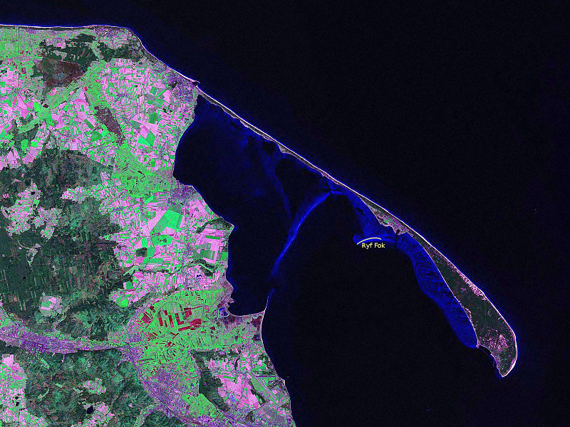
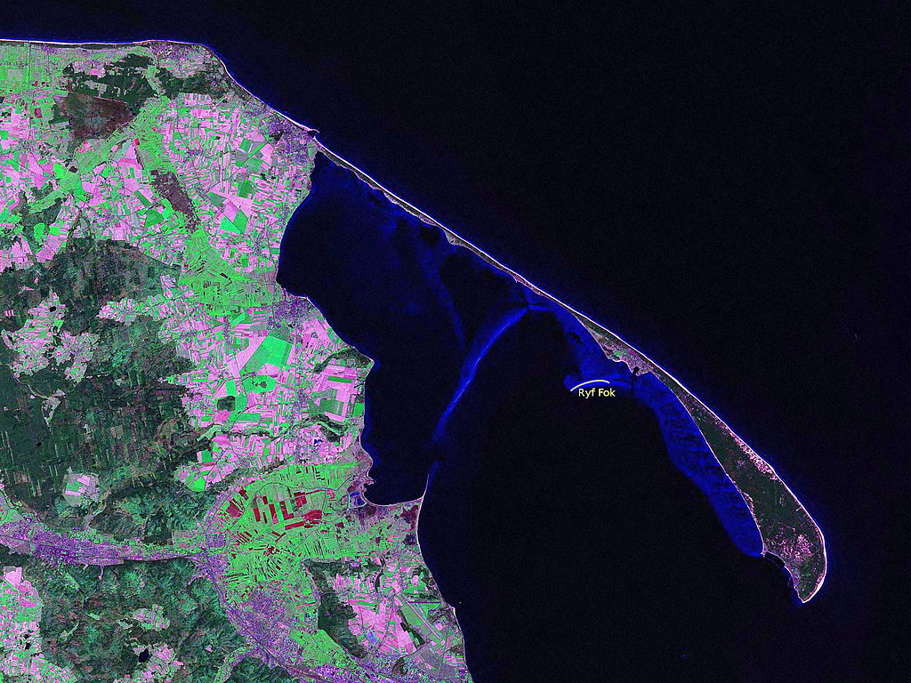
Polski: Położenie Ryfu Fok na tle zdjęcia satelitarnego Zatoki Puckiej i Mierzei Helskiej
Drawing on the Landsat satellite photo: File:Mierzeja Helska.jpg
Loaded from English Wikipedia (http://en.wikipedia.org/wiki/Image:Mierzeja_Helska.jpg); loaded there by en:User:Halibutt
Hel Peninsula as seen from the Landsat satellite. Picture taken in 2000 Uploaded from NASA archive copy at the Wayback Machine
Licensing
[edit]
| This file is in the public domain in the United States because it was solely created by NASA. NASA copyright policy states that "NASA material is not protected by copyright unless noted". (See Template:PD-USGov, NASA copyright policy page or JPL Image Use Policy.) | ||
 |
Warnings:
|
File history
Click on a date/time to view the file as it appeared at that time.
| Date/Time | Thumbnail | Dimensions | User | Comment | |
|---|---|---|---|---|---|
| current | 20:17, 11 May 2013 | | 1,600 × 1,200 (534 KB) | Julo (talk | contribs) | == {{int:filedesc}} == {{pl|Położenie Ryfu Fok na tle zdjęcia satelitarnego Zatoki Puckiej i Mierzei Helskiej}} Drawing on the Landsat satellite photo: File:Mierzeja Helska.jpg Loaded from English Wikipedia (http://en.wikipedia.org/wiki/Image... |
You cannot overwrite this file.
File usage on Commons
The following page uses this file:
File usage on other wikis
The following other wikis use this file:
- Usage on pl.wikipedia.org