File:Rydzyna (gmina) location map.png
Jump to navigation
Jump to search
Size of this preview: 583 × 600 pixels. Other resolutions: 233 × 240 pixels | 467 × 480 pixels | 701 × 721 pixels.
Original file (701 × 721 pixels, file size: 80 KB, MIME type: image/png)
Captions
Captions
Add a one-line explanation of what this file represents
| Description |
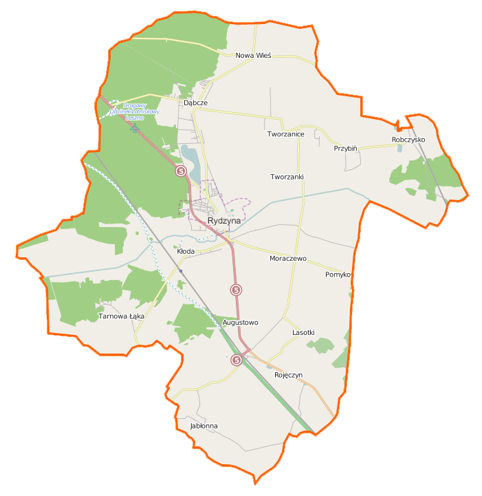
Polski: Mapa gminy Rydzyna, Polska
English: Map of Gmina Rydzyna, Poland |
|||||||||
| Date | ||||||||||
| Source | You may find a page on the OpenStreetMap wiki page for Rydzyna (gmina)) | |||||||||
| Creator |
OpenStreetMap contributors OpenStreetMap contributors |
|||||||||
| Permission (Reusing this file) |
OpenStreetMap data is available under the Open Database License (details). Map tiles are licensed under the Creative Commons Attribution-ShareAlike 2.0 license (CC-BY-SA 2.0).
This file is licensed under the Creative Commons Attribution-Share Alike 2.0 Generic license.
|
|||||||||
| Geotemporal data | ||||||||||
| Bounding box |
|
|||||||||
| Georeferencing | If inappropriate please set warp_status = skip to hide. | |||||||||
File history
Click on a date/time to view the file as it appeared at that time.
| Date/Time | Thumbnail | Dimensions | User | Comment | |
|---|---|---|---|---|---|
| current | 10:56, 14 December 2014 | | 701 × 721 (80 KB) | VanWiel (talk | contribs) | {{OpenStreetMap | name = Rydzyna (gmina)) | location = Rydzyna (gmina) | description = {{pl|Mapa gminy Rydzyna, Polska}} {{en|Map of Gmina Rydzyna, Poland}} | top = 51.8546 | bottom = 51.7015 | left... |
You cannot overwrite this file.
File usage on Commons
There are no pages that use this file.
File usage on other wikis
The following other wikis use this file:
- Usage on fr.wikipedia.org
- Usage on pl.wikipedia.org
- Rydzyna
- Zamek w Rydzynie
- Rydzyna (gmina)
- Dąbcze
- Pomykowo
- Przybiń
- Robczysko
- Rojęczyn
- Tarnowa Łąka
- Tworzanice
- Tworzanki
- Kaczkowo (województwo wielkopolskie)
- Lasotki (województwo wielkopolskie)
- Augustowo (powiat leszczyński)
- Jabłonna (powiat leszczyński)
- Kłoda (powiat leszczyński)
- Moraczewo (powiat leszczyński)
- Nowa Wieś (powiat leszczyński)
- Junoszyn
- Nowy Świat (powiat leszczyński)
- Rydzyna (przystanek kolejowy)
- Maruszewo (województwo wielkopolskie)
- Parafia św. Stanisława Biskupa w Rydzynie
- Kaczkowo (przystanek kolejowy)
- Kościół św. Stanisława Biskupa w Rydzynie
- Izbiska (województwo wielkopolskie)
- Dąbcze (osada leśna)
- Muzeum Rolnictwa i Młynarstwa w Rydzynie
- Robczysko (osada leśna)
- Rydzyna (osada w województwie wielkopolskim)
- Kościół ewangelicki w Rydzynie
- Moduł:Mapa/dane/Rydzyna
- Moduł:Mapa/dane/Rydzyna (gmina)
- Parafia św. Katarzyny w Dąbczu
- Parafia św. Marcina w Kaczkowie
- Kościół św. Katarzyny Aleksandryjskiej w Dąbczu
- Kościół św. Mikołaja w Jabłonnie
- Kościół św. Marcina w Kaczkowie
- Pałac w Jabłonnej
- Usage on pl.wikibooks.org
_location_map.png&oldid=506179252)