File:Ryńsk (gmina) location map.png
Jump to navigation
Jump to search

Size of this preview: 657 × 599 pixels. Other resolutions: 263 × 240 pixels | 526 × 480 pixels | 842 × 768 pixels | 1,037 × 946 pixels.
Original file (1,037 × 946 pixels, file size: 123 KB, MIME type: image/png)
Captions
Captions
Add a one-line explanation of what this file represents
| Description |
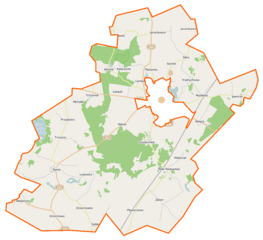
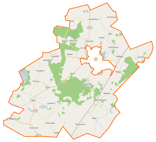
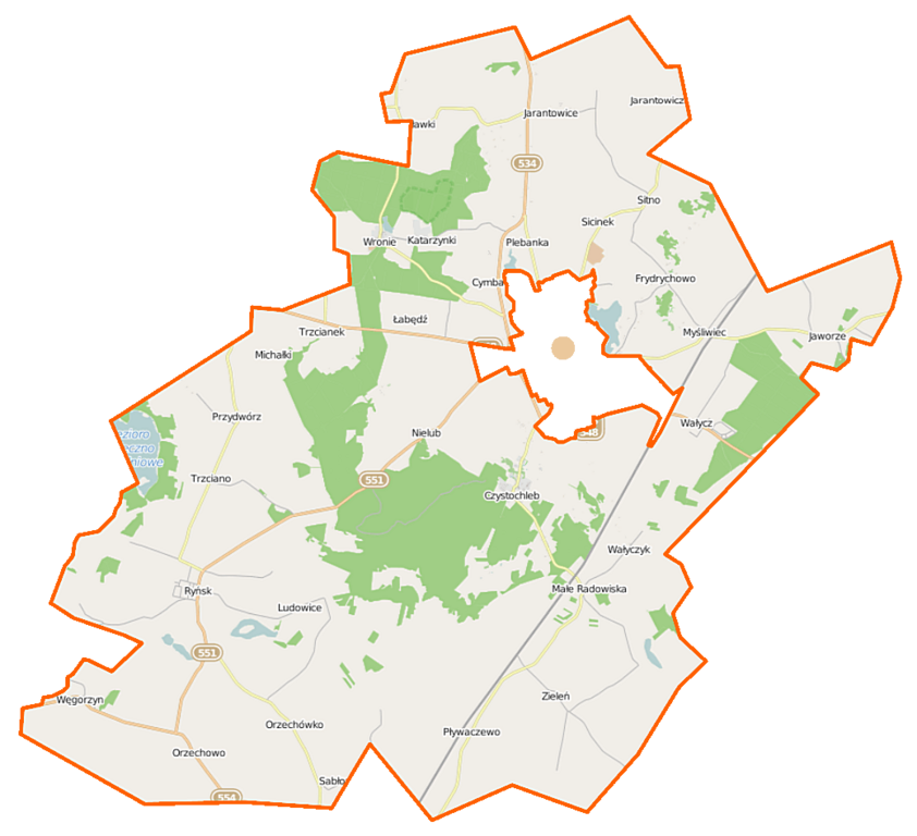
Polski: Mapa gminy Ryńsk, Polska
English: Map of Gmina Ryńsk, Poland |
|||||||||
| Date | ||||||||||
| Source | You may find a page on the OpenStreetMap wiki page for Ryńsk (gmina) | |||||||||
| Creator |
OpenStreetMap contributors OpenStreetMap contributors |
|||||||||
| Permission (Reusing this file) |
OpenStreetMap data is available under the Open Database License (details). Map tiles are licensed under the Creative Commons Attribution-ShareAlike 2.0 license (CC-BY-SA 2.0).
This file is licensed under the Creative Commons Attribution-Share Alike 2.0 Generic license.
|
|||||||||
| Geotemporal data | ||||||||||
| Bounding box |
|
|||||||||
| Georeferencing | If inappropriate please set warp_status = skip to hide. | |||||||||
File history
Click on a date/time to view the file as it appeared at that time.
| Date/Time | Thumbnail | Dimensions | User | Comment | |
|---|---|---|---|---|---|
| current | 09:17, 21 November 2014 | | 1,037 × 946 (123 KB) | VanWiel (talk | contribs) | {{Information |Description= |Source= |Date= |Author= |Permission= |other_versions= }} |
| 08:29, 20 November 2014 |  | 1,037 × 946 (103 KB) | VanWiel (talk | contribs) | {{OpenStreetMap | name = Wąbrzeźno (gmina wiejska) | location = Wąbrzeźno (gmina wiejska) | description = {{pl|Mapa gminy Wąbrzeźno, Polska}} {{en|Map of Gmina Wąbrzeźno, Poland}} | top = 53.3518 |... |
You cannot overwrite this file.
File usage on Commons
The following page uses this file:
- File:Wąbrzeźno (gmina wiejska) location map.png (file redirect)
_location_map.png&redirect=no)
File usage on other wikis
The following other wikis use this file:
- Usage on de.wikipedia.org
- Usage on pl.wikipedia.org
- Ryńsk (gmina)
- Cymbark
- Czystochleb
- Ludowice
- Małe Radowiska
- Nielub
- Pływaczewo
- Przydwórz
- Ryńsk
- Myśliwiec (wieś)
- Stanisławki (województwo kujawsko-pomorskie)
- Trzcianek
- Wałycz
- Wałyczyk
- Jaworze (województwo kujawsko-pomorskie)
- Łabędź (województwo kujawsko-pomorskie)
- Orzechowo (województwo kujawsko-pomorskie)
- Orzechówko (województwo kujawsko-pomorskie)
- Trzciano (województwo kujawsko-pomorskie)
- Węgorzyn (województwo kujawsko-pomorskie)
- Zieleń (województwo kujawsko-pomorskie)
- Jarantowice (powiat wąbrzeski)
- Sitno (powiat wąbrzeski)
- Katarzynki (województwo kujawsko-pomorskie)
- Wronie
- Plebanka (powiat wąbrzeski)
- Frydrychowo (powiat wąbrzeski)
- Jarantowiczki
- Michałki (powiat wąbrzeski)
- Rozgard
- Młynik (województwo kujawsko-pomorskie)
- Sicinek
- Zaradowiska
- Sosnówka (powiat wąbrzeski)
- Prochy (województwo kujawsko-pomorskie)
- Bugeria
- Zieleń (przystanek kolejowy)
- Wieczno
- Wikipedysta:Kosqx/brudnopis
- Pigża (powiat wąbrzeski)
- Rezerwat przyrody Wronie
- Orzechowo-Majątek
- Seperanka
- Seperunki
- Zieleńskie Góry
- Buk (województwo kujawsko-pomorskie)
- Wronie (osada leśna)
- Moduł:Mapa/dane/Ryńsk (gmina)
- Parafia św. Marii Magdaleny w Orzechowie
View more global usage of this file.
_location_map.png)
_location_map.png&oldid=472339534)