File:Ruta Nacional 40 Santa Cruz.svg
Jump to navigation
Jump to search

Size of this PNG preview of this SVG file: 482 × 600 pixels. Other resolutions: 193 × 240 pixels | 386 × 480 pixels | 617 × 768 pixels | 823 × 1,024 pixels | 1,646 × 2,048 pixels | 688 × 856 pixels.
Original file (SVG file, nominally 688 × 856 pixels, file size: 104 KB)
Captions
Captions
Add a one-line explanation of what this file represents
Summary
[edit]
| Description |
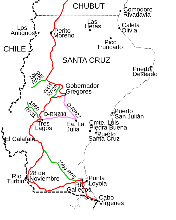
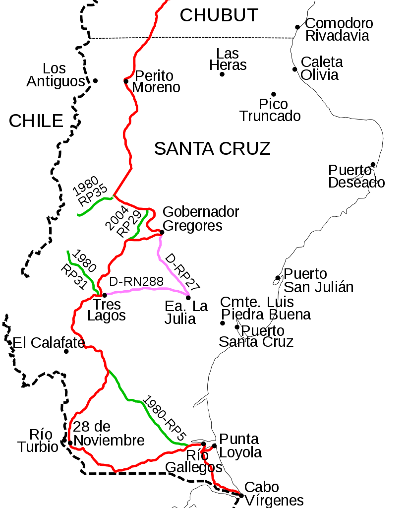
Español: Mapa de la Ruta Nacional 40 en la Provincia de Santa Cruz, Argentina. El recorrido actual está marcado en rojo. En verde claro se indican las trazas antiguas junto con el año en que dejaron a pertenecer a la Ruta 40 y el número de ruta actual. En violeta claro se encuentra el desvío que debían realizar los vehículos cuando la ruta no estaba completa. En este caso también se mustra el número de ruta nacional o provincial actual. |
| Date | |
| Source | Own work |
| Author | Dario Alpern |
Licensing
[edit]
I, the copyright holder of this work, hereby publish it under the following license:

|
Permission is granted to copy, distribute and/or modify this document under the terms of the GNU Free Documentation License, Version 1.2 or any later version published by the Free Software Foundation; with no Invariant Sections, no Front-Cover Texts, and no Back-Cover Texts. A copy of the license is included in the section entitled GNU Free Documentation License. |
| This file is licensed under the Creative Commons Attribution-Share Alike 3.0 Unported license. | ||
| ||
| This licensing tag was added to this file as part of the GFDL licensing update. |
File history
Click on a date/time to view the file as it appeared at that time.
| Date/Time | Thumbnail | Dimensions | User | Comment | |
|---|---|---|---|---|---|
| current | 22:51, 2 June 2018 | | 688 × 856 (104 KB) | Janitoalevic (talk | contribs) | . |
| 22:47, 2 June 2018 |  | 688 × 856 (103 KB) | Janitoalevic (talk | contribs) | Added Cape Vírgenes | |
| 20:55, 23 November 2008 |  | 688 × 856 (100 KB) | Alpertron (talk | contribs) | Better colors | |
| 00:56, 28 October 2008 |  | 688 × 856 (100 KB) | Alpertron (talk | contribs) | More information | |
| 13:32, 25 October 2008 |  | 688 × 856 (93 KB) | Alpertron (talk | contribs) | Fonts were corrected | |
| 13:28, 25 October 2008 |  | 688 × 856 (87 KB) | Alpertron (talk | contribs) | {{Information |Description={{es|1=Mapa de la Ruta Nacional 40 en la Provincia de Santa Cruz, Argentina. El recorrido actual está marcado en rojo. En verde se encuentra la traza anterior a 2004 y en violeta la traza anterior a 1980.}} |Source=trabajo prop |
You cannot overwrite this file.
File usage on Commons
The following 3 pages use this file:
File usage on other wikis
The following other wikis use this file:
- Usage on es.wikipedia.org
- Usage on fr.wikipedia.org