File:Rushyford Water, Bodmin Moor - geograph.org.uk - 842630.jpg
Jump to navigation
Jump to search
No higher resolution available.
Rushyford_Water,_Bodmin_Moor_-_geograph.org.uk_-_842630.jpg (640 × 480 pixels, file size: 112 KB, MIME type: image/jpeg)
Captions
Captions
Add a one-line explanation of what this file represents
Summary
[edit]
| Description |
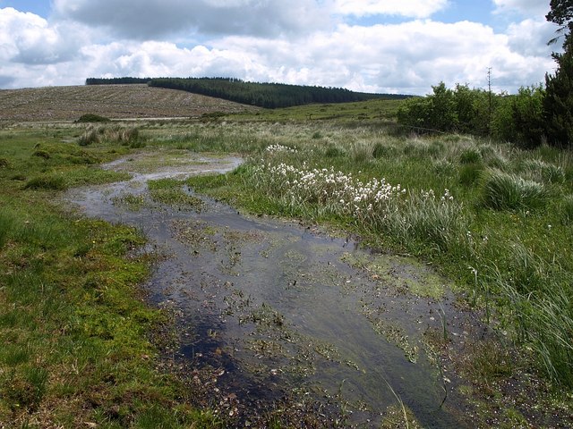
English: Rushyford Water, Bodmin Moor The stream, a tributary of Withey Brook, spreads into East Moor, creating a marshy area north of Goodaver Downs, as it leaves the edge of Halvana Plantation and heads eastwards on its way to its junction with the River Lynher. The bright seedheads of cotton grass (Eriophorum angustifolium) are on the right. In the distance is Smallacoombe Downs, where a large swathe of the plantations has been felled. |
| Date | |
| Source | From geograph.org.uk |
| Author | Derek Harper |
| Attribution (required by the license) | Derek Harper / Rushyford Water, Bodmin Moor / |
| Camera location | | View this and other nearby images on: OpenStreetMap |
|---|
_heading:112.00&language=en)
| Object location | | View this and other nearby images on: OpenStreetMap |
|---|
_heading:112.00&language=en)
Licensing
[edit]

|
This image was taken from the Geograph project collection. See this photograph's page on the Geograph website for the photographer's contact details. The copyright on this image is owned by Derek Harper and is licensed for reuse under the Creative Commons Attribution-ShareAlike 2.0 license.
|
This file is licensed under the Creative Commons Attribution-Share Alike 2.0 Generic license.
Attribution: Derek Harper
- You are free:
- to share – to copy, distribute and transmit the work
- to remix – to adapt the work
- Under the following conditions:
- attribution – You must give appropriate credit, provide a link to the license, and indicate if changes were made. You may do so in any reasonable manner, but not in any way that suggests the licensor endorses you or your use.
- share alike – If you remix, transform, or build upon the material, you must distribute your contributions under the same or compatible license as the original.
File history
Click on a date/time to view the file as it appeared at that time.
| Date/Time | Thumbnail | Dimensions | User | Comment | |
|---|---|---|---|---|---|
| current | 23:56, 20 February 2011 | | 640 × 480 (112 KB) | GeographBot (talk | contribs) | == {{int:filedesc}} == {{Information |description={{en|1=Rushyford Water, Bodmin Moor The stream, a tributary of Withey Brook, spreads into East Moor, creating a marshy area north of Goodaver Downs, as it leaves the edge of Halvana Plantation and heads ea |
You cannot overwrite this file.
File usage on Commons
There are no pages that use this file.