File:Ruotsi-Suomi ennen Suomen sotaa.png
Jump to navigation
Jump to search
Size of this preview: 376 × 599 pixels. Other resolutions: 150 × 240 pixels | 301 × 480 pixels | 482 × 768 pixels | 642 × 1,024 pixels | 2,014 × 3,210 pixels.
Original file (2,014 × 3,210 pixels, file size: 2.44 MB, MIME type: image/png)
Captions
Captions
Add a one-line explanation of what this file represents
kartta ei ole oikea, se on täysin väärä tietoineen ja esityksineen. Teidän täytyy poistaa tämä kartta täysin. This map is total wrong, and it must be forbidden to public this kind of informations on these sides.You must put away this map. Diese Karte entspricht den Tatsachen überhaupt nicht und es ist verboten diese Art von Informationen zu veröffentlichen.
Summary
[edit]
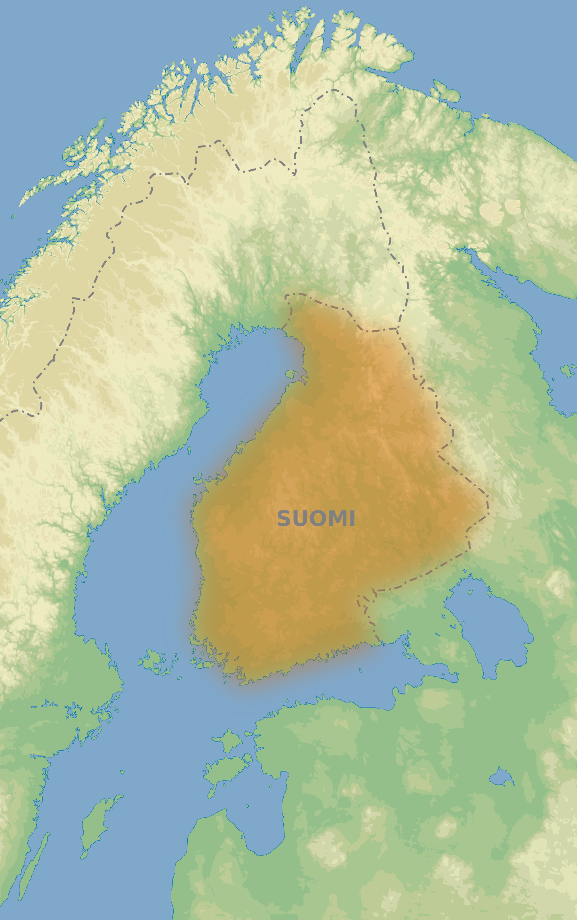
| Description | Map of Kingdom of Sweden in end of 1700. Finland is separeted from Sweden in this map. |
| Date | 1 February 2008 (upload date) |
| Source | self-made. Data from [1]. Borders [2] |
| Author | QWerk |
![[2]](http://virtual.finland.fi/finfo/english/map/map18.jpg)
Licensing
[edit]
| I, the copyright holder of this work, release this work into the public domain. This applies worldwide. In some countries this may not be legally possible; if so: I grant anyone the right to use this work for any purpose, without any conditions, unless such conditions are required by law. |
File history
Click on a date/time to view the file as it appeared at that time.
| Date/Time | Thumbnail | Dimensions | User | Comment | |
|---|---|---|---|---|---|
| current | 09:13, 1 February 2008 | | 2,014 × 3,210 (2.44 MB) | QWerk (talk | contribs) | {{Information |Description=Map of Kingdom of Sweden in end of 1700. Finland is separeted from Sweden in this map. |Source=self-made. Data from [http://www.ngdc.noaa.gov/mgg/topo/gltiles.html]. Borders [http://virtual.finland.fi/finfo/english/map/map18.jpg |
You cannot overwrite this file.
File usage on Commons
There are no pages that use this file.
File usage on other wikis
The following other wikis use this file:
- Usage on et.wikipedia.org
- Usage on ru.wikipedia.org
- Usage on uk.wikipedia.org