File:Rummelkarte-1.jpg
Jump to navigation
Jump to search

Size of this preview: 800 × 533 pixels. Other resolutions: 320 × 213 pixels | 640 × 426 pixels | 1,024 × 682 pixels | 1,280 × 853 pixels | 1,600 × 1,066 pixels.
Original file (1,600 × 1,066 pixels, file size: 2.13 MB, MIME type: image/jpeg)
Captions
Captions
Add a one-line explanation of what this file represents
Summary
[edit]
| Description |
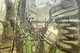
Русский: Лист карты, исполненный картографом Руммелем Й.Ф.К. в 1802 году. Изображена часть современной территории Обербергишес-Ланд. |
| Date | |
| Source |
Historische Karten aus dem Oberbergischen / Bl. Nr. H5. Forst-Carte des Gimborner Reviers [2004], [Nachdr. der Ausg.] 1802/03, Verkleinerung des Orig.-Maßstabes 1:11 300 |
| Author | Kartograf Rummel, J. F. C. |
Licensing
[edit]
|
This work is in the public domain in its country of origin and other countries and areas where the copyright term is the author's life plus 70 years or fewer. | |
| This file has been identified as being free of known restrictions under copyright law, including all related and neighboring rights. | |
File history
Click on a date/time to view the file as it appeared at that time.
| Date/Time | Thumbnail | Dimensions | User | Comment | |
|---|---|---|---|---|---|
| current | 15:31, 28 March 2023 | | 1,600 × 1,066 (2.13 MB) | Velopilger (talk | contribs) | Uploaded a work by Kartograf Rummel, J. F. C. from Historische Karten aus dem Oberbergischen / Bl. Nr. H5. Forst-Carte des Gimborner Reviers [2004], [Nachdr. der Ausg.] 1802/03, Verkleinerung des Orig.-Maßstabes 1:11 300 with UploadWizard |
You cannot overwrite this file.
File usage on Commons
There are no pages that use this file.