File:Rumbold house.png
Jump to navigation
Jump to search
Size of this preview: 800 × 519 pixels. Other resolutions: 320 × 208 pixels | 640 × 415 pixels | 1,024 × 664 pixels | 1,280 × 830 pixels | 2,560 × 1,661 pixels | 3,757 × 2,437 pixels.
Original file (3,757 × 2,437 pixels, file size: 4.56 MB, MIME type: image/png)
Captions
Captions
Add a one-line explanation of what this file represents
Summary
[edit]
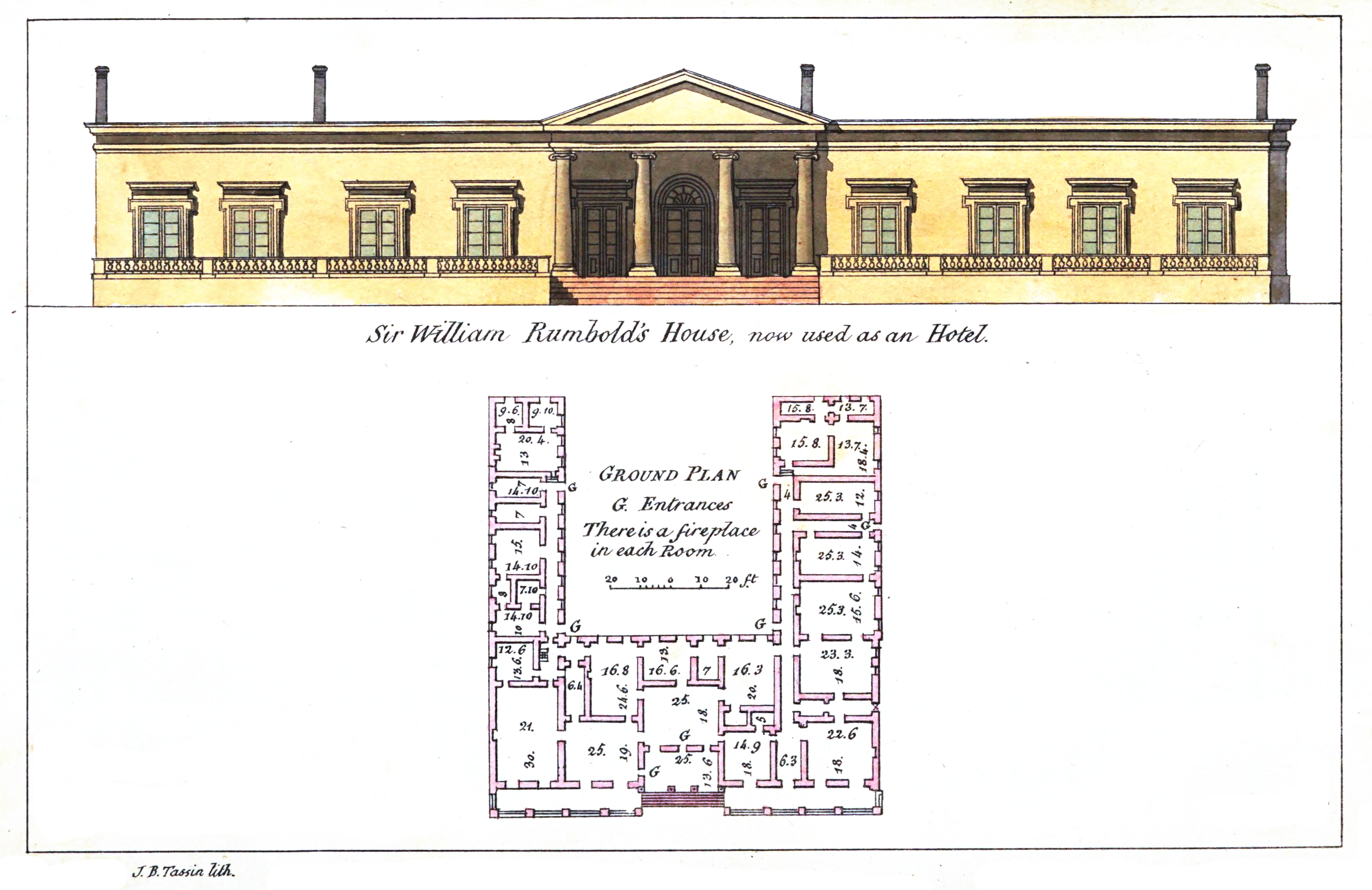
| Description | View of Rumbold's home, now Ootacamund Club | ||||
| Date | |||||
| Source | Observations on the Neilgherries including an account of their topography, climate, soil, & productions, and of the effects of the climate on the European constitution / By R. Baikie | ||||
| Author | R. Baikie | ||||
| Permission (Reusing this file) |
|
||||
| Camera location | | View this and other nearby images on: OpenStreetMap |
|---|
File history
Click on a date/time to view the file as it appeared at that time.
| Date/Time | Thumbnail | Dimensions | User | Comment | |
|---|---|---|---|---|---|
| current | 03:26, 15 April 2024 | | 3,757 × 2,437 (4.56 MB) | Shyamal (talk | contribs) | {{Information |Description=View of Rumbold's home, now Ootacamund Club |Source=Observations on the Neilgherries including an account of their topography, climate, soil, & productions, and of the effects of the climate on the European constitution / By R. Baikie |Date=1834 |Author=R. Baikie |Permission={{pd-old}} |other_versions= }} Category:Ootacamund Gymkhana Club |
You cannot overwrite this file.
File usage on Commons
There are no pages that use this file.