File:Rud-e Mand River Near Tasuj.jpg
Jump to navigation
Jump to search

Size of this preview: 800 × 600 pixels. Other resolutions: 320 × 240 pixels | 640 × 480 pixels | 1,024 × 768 pixels | 1,280 × 960 pixels | 1,600 × 1,200 pixels.
Original file (1,600 × 1,200 pixels, file size: 1.14 MB, MIME type: image/jpeg)
Captions
Captions
Add a one-line explanation of what this file represents
Summary
[edit]
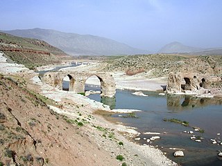
| Description | Rud-e Mand River Near Tasuj |
| Date | 27 April 2005, 14:00 (according to Exif data) |
| Source | panoramio |
| Author | Raki_Man |
| Camera location | | View this and other nearby images on: OpenStreetMap |
|---|
Licensing
[edit]
This file is licensed under the Creative Commons Attribution 3.0 Unported license.
- You are free:
- to share – to copy, distribute and transmit the work
- to remix – to adapt the work
- Under the following conditions:
- attribution – You must give appropriate credit, provide a link to the license, and indicate if changes were made. You may do so in any reasonable manner, but not in any way that suggests the licensor endorses you or your use.
| This image, which was originally posted to Panoramio, was reviewed on 26 February 2013 by the administrator or trusted user Morning Sunshine, who confirmed that it was available on Panoramio under the above license on that date. |
File history
Click on a date/time to view the file as it appeared at that time.
| Date/Time | Thumbnail | Dimensions | User | Comment | |
|---|---|---|---|---|---|
| current | 15:37, 25 February 2013 | | 1,600 × 1,200 (1.14 MB) | Glabb (talk | contribs) | {{Information |Description=Rud-e Mand River Near Tasuj |Source=[http://www.panoramio.com/photo/313482 panoramio] |Date=2005-04-27 14:00 |Author=[http://www.panoramio.com/user/56171 Raki_Man] |Permission= |other_versions= }} {{Location dec|29.181841|52.... |
You cannot overwrite this file.
File usage on Commons
There are no pages that use this file.