File:Rozwój terytorialny Krakowa.jpg
Jump to navigation
Jump to search

Size of this preview: 800 × 455 pixels. Other resolutions: 320 × 182 pixels | 640 × 364 pixels | 1,024 × 583 pixels.
Original file (1,024 × 583 pixels, file size: 74 KB, MIME type: image/jpeg)
Captions
Captions
Add a one-line explanation of what this file represents

|
File:Rozwój terytorialny Krakowa - PL.svg is a vector version of this file. It should be used in place of this JPG file when not inferior.
File:Rozwój terytorialny Krakowa.jpg → File:Rozwój terytorialny Krakowa - PL.svg
For more information, see Help:SVG. |
 |
Summary
[edit]
| Description |
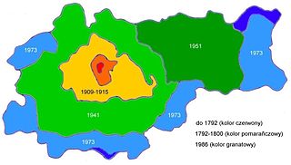
Polski: Poszerzanie granic administracyjnych Krakowa |
| Date | |
| Source | Own work na podstawie Encyklopedii Krakowa |
| Author | Gambitek |
| Other versions | File:Rozwój terytorialny Krakowa (2).jpg in English language |
.jpg)
Licensing
[edit]
I, the copyright holder of this work, hereby publish it under the following licenses:

|
Permission is granted to copy, distribute and/or modify this document under the terms of the GNU Free Documentation License, Version 1.2 or any later version published by the Free Software Foundation; with no Invariant Sections, no Front-Cover Texts, and no Back-Cover Texts. A copy of the license is included in the section entitled GNU Free Documentation License. |
This file is licensed under the Creative Commons Attribution-Share Alike 4.0 International, 3.0 Unported, 2.5 Generic, 2.0 Generic and 1.0 Generic license.
- You are free:
- to share – to copy, distribute and transmit the work
- to remix – to adapt the work
- Under the following conditions:
- attribution – You must give appropriate credit, provide a link to the license, and indicate if changes were made. You may do so in any reasonable manner, but not in any way that suggests the licensor endorses you or your use.
- share alike – If you remix, transform, or build upon the material, you must distribute your contributions under the same or compatible license as the original.
You may select the license of your choice.
File history
Click on a date/time to view the file as it appeared at that time.
| Date/Time | Thumbnail | Dimensions | User | Comment | |
|---|---|---|---|---|---|
| current | 19:01, 24 March 2009 | | 1,024 × 583 (74 KB) | Gambitek (talk | contribs) | {{Information |Description={{pl|1=Rozwój przestrzenny miasta Krakowa}} |Source=Praca własna osoby przesyłającej (own work by uploader) |Author=Gambitek |Date=24.03.2009 |Permission= |other_versions= }} <!--{{ImageUpload|full}}--> |
| 18:48, 14 March 2009 |  | 1,024 × 583 (69 KB) | Gambitek (talk | contribs) | {{Information |Description={{pl|1=Poszerzanie granic administracyjnych Krakowa}} |Source=Praca własna osoby przesyłającej (own work by uploader) na podstawie Encyklopedii Krakowa |Author=Gambitek |Date=14.03.2009 |Permission= |other_v |
You cannot overwrite this file.
File usage on Commons
There are no pages that use this file.