File:Row of Craters on Laki Fissure in Iceland.jpg
Jump to navigation
Jump to search

Size of this preview: 800 × 600 pixels. Other resolutions: 320 × 240 pixels | 640 × 480 pixels | 1,024 × 768 pixels | 1,280 × 960 pixels | 2,560 × 1,920 pixels | 4,320 × 3,240 pixels.
Original file (4,320 × 3,240 pixels, file size: 5.54 MB, MIME type: image/jpeg)
Captions
Captions
Add a one-line explanation of what this file represents
Summary
[edit]
| Description |
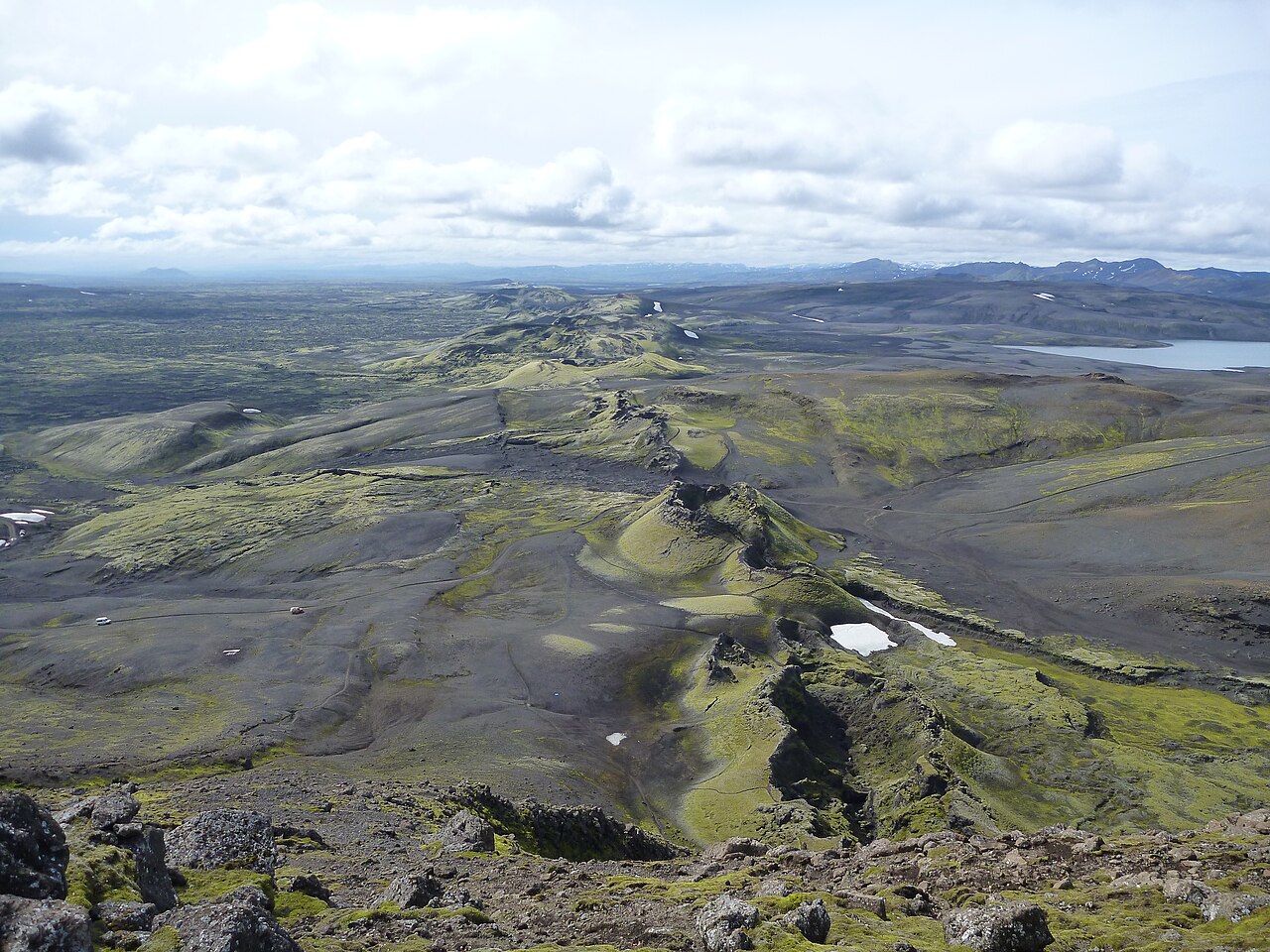
English: The Laki crater row in southern Iceland opened during the eruptive period of 1783-1784 releasing poisonous gasses into the atmosphere that killed >50% of Iceland's livestock. The eruption caused a drop in global temperatures leading to crop failures and famine in Europe and droughts in India. Credit: Anne Schöpa (distributed via imaggeo.egu.eu). |
| Date | |
| Source | https://imaggeo.egu.eu/view/5212/ |
| Author | Anne Schöpa |
| Camera location | | View this and other nearby images on: OpenStreetMap |
|---|
Licensing
[edit]
This file is licensed under the Creative Commons Attribution 3.0 Unported license.
- You are free:
- to share – to copy, distribute and transmit the work
- to remix – to adapt the work
- Under the following conditions:
- attribution – You must give appropriate credit, provide a link to the license, and indicate if changes were made. You may do so in any reasonable manner, but not in any way that suggests the licensor endorses you or your use.
This file, which was originally posted to
https://imaggeo.egu.eu/view/5212/, was reviewed on 13 May 2018 by reviewer Leoboudv, who confirmed that it was available there under the stated license on that date.
|
File history
Click on a date/time to view the file as it appeared at that time.
| Date/Time | Thumbnail | Dimensions | User | Comment | |
|---|---|---|---|---|---|
| current | 12:21, 11 May 2018 | | 4,320 × 3,240 (5.54 MB) | GeoWriter (talk | contribs) | User created page with UploadWizard |
You cannot overwrite this file.
File usage on Commons
There are no pages that use this file.
File usage on other wikis
The following other wikis use this file:
- Usage on cs.wikipedia.org
- Usage on he.wikipedia.org
- Usage on it.wikibooks.org
- Usage on nn.wikipedia.org
- Usage on sv.wikipedia.org