File:Route33a.jpg
Jump to navigation
Jump to search
Size of this preview: 800 × 600 pixels. Other resolutions: 320 × 240 pixels | 640 × 480 pixels | 1,024 × 768 pixels.
Original file (1,024 × 768 pixels, file size: 151 KB, MIME type: image/jpeg)
Captions
Captions
Add a one-line explanation of what this file represents
Summary
[edit]
| Description |
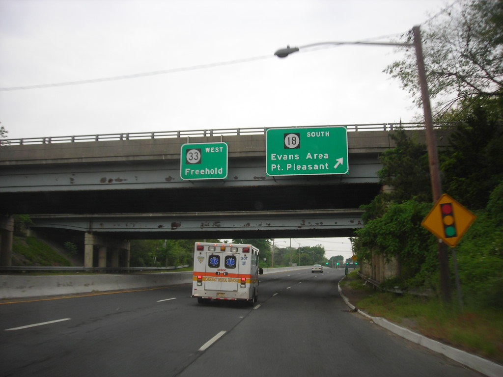
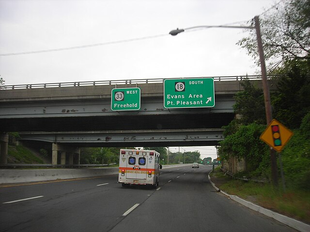
English: Route 33 westbound at the junction with Route 18 |
| Date | |
| Source | https://www.flickr.com/photos/dougtone/4158350549/in/set-72157622937013352 |
| Author | dougtone |
Licensing
[edit]
This file is licensed under the Creative Commons Attribution-Share Alike 2.0 Generic license.
- You are free:
- to share – to copy, distribute and transmit the work
- to remix – to adapt the work
- Under the following conditions:
- attribution – You must give appropriate credit, provide a link to the license, and indicate if changes were made. You may do so in any reasonable manner, but not in any way that suggests the licensor endorses you or your use.
- share alike – If you remix, transform, or build upon the material, you must distribute your contributions under the same or compatible license as the original.
| This image was originally posted to Flickr by dougtone at https://www.flickr.com/photos/7327243@N05/4158350549. It was reviewed on 15 October 2011 by FlickreviewR and was confirmed to be licensed under the terms of the cc-by-sa-2.0. |
File history
Click on a date/time to view the file as it appeared at that time.
| Date/Time | Thumbnail | Dimensions | User | Comment | |
|---|---|---|---|---|---|
| current | 05:14, 15 October 2011 | | 1,024 × 768 (151 KB) | Tinton5 (talk | contribs) | {{Information |Description ={{en|1=Route 33 westbound at the junction with Route 18}} |Source =http://www.flickr.com/photos/dougtone/4158350549/in/set-72157622937013352 |Author =dougtone |Date =May 28, 2007 |Permission = | |
You cannot overwrite this file.
File usage on Commons
There are no pages that use this file.
Metadata
Categories:
- Road signs along New Jersey Route 33 in Monmouth County
- Roads in Neptune Township, New Jersey
- Guide road signs in New Jersey
- Warning road signs in New Jersey
- Road signs for New Jersey Route 18 along other roads in Monmouth County
- Road signs for Camp Evans
- Road signs for Point Pleasant, New Jersey
- Road signs for Freehold, New Jersey