File:RoundMountainAerial.png
Jump to navigation
Jump to search

Size of this preview: 776 × 600 pixels. Other resolutions: 311 × 240 pixels | 621 × 480 pixels | 994 × 768 pixels | 1,280 × 989 pixels | 2,560 × 1,978 pixels | 3,300 × 2,550 pixels.
Original file (3,300 × 2,550 pixels, file size: 11.09 MB, MIME type: image/png)
Captions
Captions
Add a one-line explanation of what this file represents
| Description |
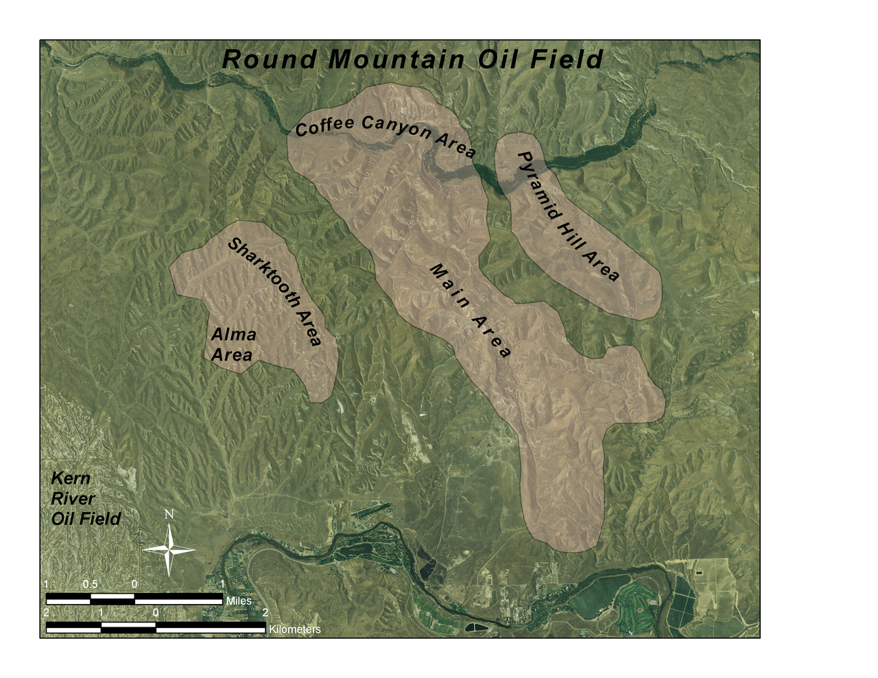
English: Round Mountain Field aerial, with subareas labeled; by me, in ArcGIS 9.2; all data is in public domain: GFDL |
| Date | 29 July 2008 (original upload date) |
| Source | Transferred from en.wikipedia to Commons by Matthiasb using CommonsHelper. |
| Author | The original uploader was Antandrus at English Wikipedia. |
Licensing
[edit]

|
Permission is granted to copy, distribute and/or modify this document under the terms of the GNU Free Documentation License, Version 1.2 or any later version published by the Free Software Foundation; with no Invariant Sections, no Front-Cover Texts, and no Back-Cover Texts. A copy of the license is included in the section entitled GNU Free Documentation License. |
| This file is licensed under the Creative Commons Attribution-Share Alike 3.0 Unported license. | ||
| ||
| This licensing tag was added to this file as part of the GFDL licensing update. |
Original upload log
[edit]
The original description page was here. All following user names refer to en.wikipedia.
- 2008-07-29 23:45 Antandrus 3300×2550×??? (11632730 bytes) Round Mountain Field aerial, with subareas labeled; by me, in ArcGIS 9.2; all data is in public domain: GFDL
File history
Click on a date/time to view the file as it appeared at that time.
| Date/Time | Thumbnail | Dimensions | User | Comment | |
|---|---|---|---|---|---|
| current | 09:52, 30 August 2008 | | 3,300 × 2,550 (11.09 MB) | Matthiasb (talk | contribs) | {{Information |Description={{en|Round Mountain Field aerial, with subareas labeled; by me, in ArcGIS 9.2; all data is in public domain: GFDL}} |Source=Transferred from [http://en.wikipedia.org en.wikipedia]; transferred to Commons by User:Matthiasb u |
You cannot overwrite this file.
File usage on Commons
There are no pages that use this file.
File usage on other wikis
The following other wikis use this file:
- Usage on de.wikipedia.org
- Usage on en.wikipedia.org