File:Rothney Castle Shimla.jpg
Jump to navigation
Jump to search
Size of this preview: 739 × 600 pixels. Other resolutions: 296 × 240 pixels | 592 × 480 pixels | 946 × 768 pixels | 1,262 × 1,024 pixels | 2,524 × 2,048 pixels | 7,590 × 6,160 pixels.
Original file (7,590 × 6,160 pixels, file size: 19.32 MB, MIME type: image/jpeg)
Captions
Captions
Add a one-line explanation of what this file represents
| Description |
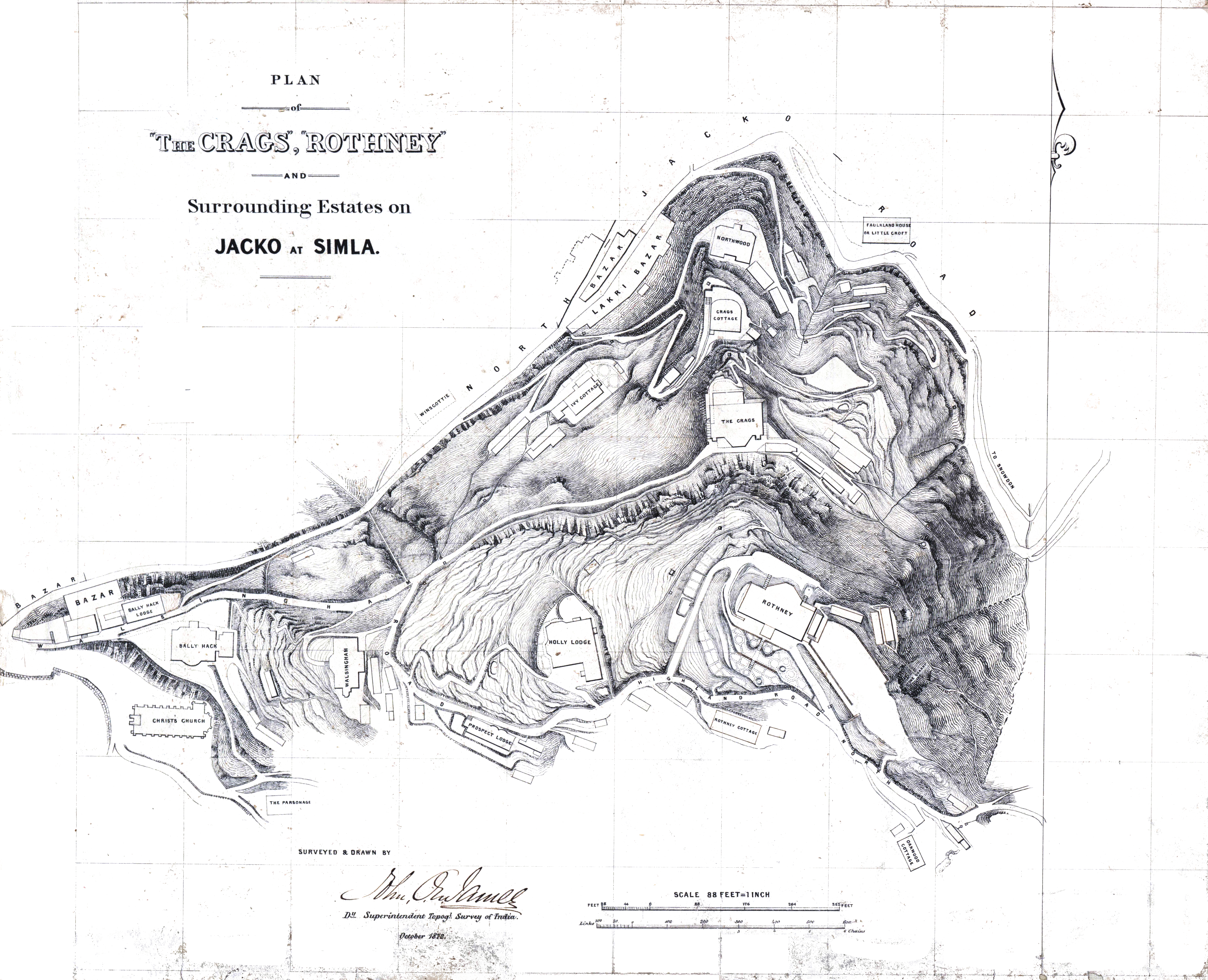
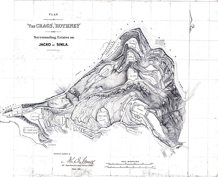
Simla - Plan of the "Crags", "Rothney" and surrounding estates on Jacko at Simla. Scale 1" to 8 feet. Surveyed and drawn by J.O.N. James. 1872. MS. F.10/7 |
|||||||||
| Date | ||||||||||
| Source | National Archives of India. Historical Maps. Folio No 10. Sheet 7.- originally by Topographical Survey of India, John James | |||||||||
| Creator |
John James, Deputy Superintendent, Topographical Survey of India |
|||||||||
| Permission (Reusing this file) |
|
|||||||||
| Geotemporal data | ||||||||||
| Bounding box |
|
|||||||||
| Georeferencing | ||||||||||
File history
Click on a date/time to view the file as it appeared at that time.
| Date/Time | Thumbnail | Dimensions | User | Comment | |
|---|---|---|---|---|---|
| current | 08:19, 27 March 2021 | | 7,590 × 6,160 (19.32 MB) | Shyamal (talk | contribs) | better image |
| 15:49, 11 August 2015 |  | 2,196 × 1,880 (1.47 MB) | Shyamal (talk | contribs) | {{Information |Description=Rothney Castle in Shimla, survey map |Source=National Archives of India. Historical Maps. Folio No 10. Sheet 7.- originally by Topographical Survey of India, John James |Date=1872 |Author=John James, Deputy Superintendent, To... |
You cannot overwrite this file.
File usage on Commons
There are no pages that use this file.
File usage on other wikis
The following other wikis use this file:
- Usage on en.wikipedia.org
- Usage on pt.wikipedia.org
- Usage on ta.wikipedia.org